🏗️ CONSTRUCTION SITE MONITORING · MONTPELLIER (34) · €250–800 LE PASSAGE
Drone construction site monitoring in Montpellier
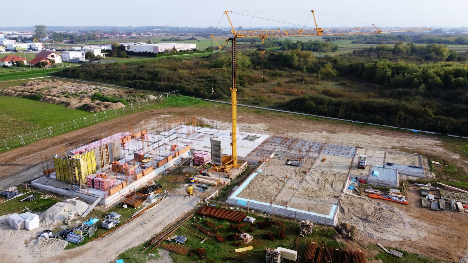
Housing estates, business parks, public facilities: around Montpellier, construction sites sprawl and are hard to track from the ground. A drone pass on a fixed date produces the same view month after month — progress becomes indisputable. From Place de la Comédie to the outlying districts, our pilots know the terrain of Montpellier and prepare every flight on the local aeronautical chart.
Demographically the fastest-growing of France's big cities, Montpellier consumes plenty of aerial imagery: housing programmes in the Port Marianne and Cambacérès districts, health-cluster campuses and clinics, Languedoc vineyards on the immediate outskirts, and tourism from the historic follies to the Palavas beaches — ideal ground for photography and inspection alike. The Montpellier-Méditerranée (Fréjorgues) CTR covers the south-east of the conurbation down to the coast, and the Lapeyronie hospital helipad generates frequent medical rotations: local coordination is essential.
What the service covers in Montpellier
- Monthly monitoring of office and housing schemes in Montpellier, from earthworks to handover
- Time-lapses and progress reports for developers and contractors in Montpellier
- Marketing communication for a property development
- Monthly orthophoto that overlays onto execution drawings
Local landmarks in Montpellier
To prepare flights in Montpellier (302,454 inhabitants, Occitanie), the pilot relies on landmarks such as:
- Place de la Comédie
- Promenade du Peyrou
- Cathédrale Saint-Pierre
- Antigone
- Château de Flaugergues
Rates
€250–800 le passage — the range observed on the 2026 French market, including regulatory preparation, flight and delivery. Every mission in Montpellier is priced on its own facts: area to cover, flight height, expected deliverable and local formalities.
Airspace and formalities in Montpellier
A monitored site in Montpellier under controlled airspace (CTR de l'aéroport Montpellier-Méditerranée) gets a standing protocol with air traffic control: once in place, each monthly pass needs only short notice.
Site monitoring is flown within the works footprint, open category on land closed to the public; in urban areas a specific-category declaration covers the project's duration and its repeated passes. Full regulations and rates: construction site monitoring across France →
Information checked against the regulations in force as of September 2026 (EU regulations 2019/945 and 2019/947, applicable French decrees).
Frequently asked questions
Construction site monitoring in Montpellier: what budget should you plan?
Allow €250–800 le passage — the 2026 French market range, including regulatory preparation, flight and delivery. In Montpellier, coordination with the local airspace is included in the quote and arranged within a few days.
How often should a site in Montpellier be flown?
The standard rhythm is monthly, tightened to fortnightly during structural work. In Occitanie, weather guides the scheduling; every flight repeats the same camera axes for rigorous month-on-month comparison.
How often should the drone fly over a site?
Monthly is most common: it matches progress-payment cycles. Fast phases (earthworks, lifting, structural work) justify fortnightly or even weekly visits for a dense timelapse.
Other drone services in Montpellier
- Real estate drone services in Montpellier from €250
- Weddings & events in Montpellier from €400
- Roof inspection in Montpellier from €200
- Facade inspection in Montpellier from €300
- Aerial thermal imaging in Montpellier from €500
- Surveying & photogrammetry in Montpellier from €800
- Precision agriculture in Montpellier from €8/ha
- All services in Montpellier
Construction site monitoring near Montpellier
- Construction site monitoring in Rodez Occitanie
- Construction site monitoring in Paris Île-de-France
- Construction site monitoring in Toulouse Occitanie
- Construction site monitoring in Nîmes Occitanie
- Construction site monitoring in Perpignan Occitanie
- Construction site monitoring in Béziers Occitanie
Construction site monitoring: every city →