LIDAR GUIDE · UPDATED OCTOBER 2026
Drone LiDAR surveys in France: choosing, commissioning and checking
New
For €39 VAT included (€32.50 excl. VAT): a guide to choose, commission and accept a drone LiDAR survey in France.
After payment
- The page after payment shows the link to your guide: you start reading right away.
- An email from C-DRONE (no-reply@tech-bharat.com) sends you this link again with your order details (amount, VAT, order number).
- Find my purchases gives you your links back at any time.
- No phone calls: nobody will ring you.
Guarantee: content as described, or your money back
For €50 more, the Pro techniques bundle: all 4 guides, this one included →
VAT included (€32.50 excl. VAT) · secure Stripe payment (card, Apple Pay, Google Pay) · terms of sale (in French)
What you get
- The online guide: 12 chapters, about 28 A4 pages, printable to PDF
- 5 ready-to-copy templates: drone LiDAR survey specification · deliverables and rights clause · ground control sheet · acceptance checklist · accuracy and density control report · and 1 more
- For: Foresters, natural area managers, archaeologists and quarry operators
- Delivery: instant online access right after payment; Stripe invoice by email
- Preview: the whole first chapter, free, further down this page
12chapters
28printable A4 pages
5templates to copy
32checklist items
Checked at the source
Reviewed by industry professionals. Every rule links to its text.
273links to official texts across our guides
71automated checks before every release
October 2026latest revision of this guide
- Primary sources: Légifrance, EUR-Lex, Géoportail, DGAC.
- Every figure linked to its source, dated in the last chapter.
- Dated updates: you always read the latest version.
Who it is for
- Engineering consultancies, surveyors and project managers commissioning or accepting a drone LiDAR survey in France
- Network and infrastructure owners (power lines, roads, railways, dykes, canals) monitoring a corridor
- Foresters, natural area managers, archaeologists and quarry operators who need the ground beneath vegetation
- Professional drone operators, French or foreign, offering LiDAR in France and needing a specification, an acceptance test and a report that clients accept
In pictures
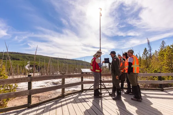
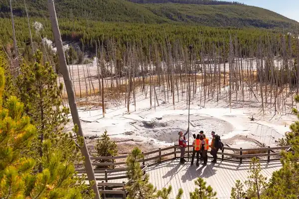
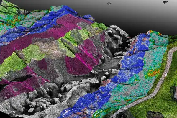
Illustrative photos, published by their authors under free licences.
Contents of the complete guide
- What a drone LiDAR actually measures (free extract below)
- LiDAR, photogrammetry or terrestrial scanning: the decision tree
- The IGN's LiDAR HD: when public data is enough
- Mission parameters and how they interact
- Trajectory, base station and control: the processing that makes accuracy
- Classification, DTM and derived products
- Checking accuracy and density: the acceptance test
- Formats, systems and deliverables: what the order must say
- Uses by sector: what changes from one survey to another
- Regulations and laser safety: what changes with a LiDAR payload
- Common mistakes
- Five templates to copy
- Sources and consultation dates
Included: 32 checklist items and 5 decision or reference tables.
Introduction
A drone LiDAR survey rarely fails because of the sensor. It fails because the order did not say what was needed: a density quoted "per square metre" without saying whether it counted every return or only the ground, no base station, check points mixed up with adjustment points, a classification delivered without the list of classes, files in a coordinate system nobody asked for. The provider replies that "it matches the quote", and they are right: the quote fixed nothing.
This guide is written to prevent that. It is for the client who commissions a survey in France (engineering consultancy, surveyor, network owner, forester, local authority) and for the professional operator who flies it, French or foreign. It explains what an airborne LiDAR actually measures and against which methods to choose it, when the open LiDAR HD data of the IGN (the French national mapping agency) is enough, how density, height, speed and overlap interact (with worked examples), what to demand from processing, classification and deliverables, and how to accept the survey. It ends with the most common mistakes and five ready-to-copy templates: specification, deliverables clause, ground control sheet, acceptance checklist and control report.
The guide is up to date as of 31 October 2026. The specifications cited (ASPRS LAS format, IGN LiDAR HD data sheets, laser standard) were checked on that date, and the French legal texts on Légifrance, the official French legal database. French terms are kept where you will meet them in French documents (Lambert-93, NGF-IGN69, géomètre-expert, cerfa). The figures in the examples are calculation assumptions, flagged as such: yours come from the sensor data sheet and the specification.
What a drone LiDAR actually measures
Three instruments, one point
An airborne LiDAR (Light Detection And Ranging) is not an improved camera. It is three instruments that must work together:
- the scanning laser rangefinder: it fires pulses, times each return and derives a distance, in a direction known from the scanning mechanism;
- the GNSS receiver: it gives the antenna position several times per second;
- the inertial measurement unit (IMU): it gives the orientation (roll, pitch, heading) and accelerations of the sensor, at high frequency.
Each point in the cloud is the result of a calculation combining antenna position, sensor orientation at the moment of firing, beam direction, measured range and the mechanical offsets between the three instruments: this is trajectory processing, followed by direct georeferencing. Cloud quality therefore depends as much on the trajectory as on the laser: an excellent scanner on a badly computed trajectory gives a cloud that is right within each strip and wrong from one strip to the next.
Multiple returns: why LiDAR sees the ground under trees
A laser pulse lights a small spot on the ground, the footprint, which grows with range. When it hits a branch, part of the energy returns and the rest carries on towards other branches and the ground: the sensor records several returns for one pulse, the first often at the top of the vegetation, the last often on the ground. That is what allows the terrain to be rebuilt beneath a canopy, as long as there are gaps.
A study by Wallace, Lucieer, Malenovský, Turner and Vopěnka, comparing a LiDAR cloud and a photogrammetric cloud captured by drone over the same open forest, illustrates the difference: both describe the canopy where cover is open, but it is the LiDAR that recovers the terrain beneath the trees (Forests, 2016, doi:10.3390/f7030062).
What LiDAR does better than photogrammetry
- The ground under vegetation (forest, hedges, scrub, riverbanks): under continuous cover, photogrammetry rebuilds the treetops.
- Thin objects (conductors, guy wires, railings): they cannot be rebuilt by image matching, but they return laser echoes.
- Textureless surfaces (fresh asphalt, smooth roofs, sand, snow): the laser measures a distance, with or without detail to match.
- Light: as an active measurement, geometry suffers neither from overcast skies nor from low sun (colour, however, does).
What it does less well
- Visual output: the cloud has no colour of its own; a high-quality orthophoto remains the domain of photogrammetry.
- Detail on open, textured surfaces (façades, stockpiles): dense photogrammetry tied to ground control often does as well, with lighter equipment.
- Water: it returns a topographic laser poorly or not at all; a topographic LiDAR does not measure a riverbed.
- Weight and processing: more payload, more steps to master and document.
Five questions to ask before commissioning
- What exactly must be measured? Bare ground, the top of vegetation, a conductor, a volume, a distance between two objects? The answer sets the density, the classes and the acceptance test.
- Is the ground visible from the air over most of the area? If so, photogrammetry may be enough. If not, LiDAR becomes necessary.
- Is the IGN's open LiDAR HD data enough? For an early study over a large area, often yes; for a condition at a given date, high density or a thin object, no (chapter 3).
- What accuracy, in which system, proven how? Accuracy without a control method is only a promise.
- Which files, for which software? Format, version, classes and coordinate system are decided before the flight, not at delivery.
The rest of the guide answers each of these questions, with the tables, calculations and templates needed to turn them into an order.
How it works
- You pay on StripeBy card, Apple Pay or Google Pay, in one go, on the checkout page hosted by Stripe: your card details never go through our servers.
- You read it right awayRight after payment, you land on the complete guide's page. Bookmark it or print it to PDF; the link and the invoice are emailed to you, and everything stays findable with “Find my purchases”, at the bottom of every page.
- Guaranteed contentAs described, or your money back: email devis@c-drone.fr and we restore access or refund you (terms of sale, in French).
Frequently asked questions
What does “Drone LiDAR surveys in France: choosing, commissioning and checking” contain and how much is it?
For €39 VAT included (€32.50 excl. VAT), you get drone LiDAR surveys in France: choosing, commissioning and checking: 12 chapters online, about 28 printable A4 pages and 5 ready-to-copy templates, to choose, commission and accept a drone LiDAR survey in France: understand the principle (laser rangefinder, GNSS, inertial unit, trajectory), decide between LiDAR, photogrammetry, terrestrial scanning and the IGN's open LiDAR HD data, set mission parameters and understand how they interact, demand verifiable processing (base station, PPK, strip adjustment, control points), ASPRS-compliant classification, well-described LAS/LAZ deliverables and a measured accuracy and density acceptance test.
How do I receive the guide?
Right after payment you are redirected to the complete guide's page. Bookmark it, or print it to PDF (Ctrl+P or Cmd+P, “Save as PDF”). Stripe also emails you the receipt.
Do I get an invoice?
Yes: Stripe generates the invoice and emails it. You can enter your company name and VAT number at checkout. Seller: Lacangel Group (VAT FR21995268018); prices VAT included.
Is the guide kept up to date?
Yes. The guide's page is updated when the rules change; your access stays valid and you always read the latest version.
Which texts is the guide based on?
On the official texts in force (EU regulations, French decrees and codes), cited and dated with their links: you can check every rule at its source, which is authoritative. C-DRONE is an independent publisher.
Which device can I read it on?
Computer, tablet or phone: it is a web page, with no app or account to create. Print it to PDF to archive it or share it within your team.
What guarantee do I get?
The content matches its description, or you get your money back: email devis@c-drone.fr and we restore access or refund you (terms of sale, in French). This also applies to business purchases.
Other guides
New Drone light show guide
Organising a drone light show in France: budget, permits, contract
Town, company or wedding: check whether your project works, file the prefecture application on time, compare quotes, sign a contract that deals with the weather and run the night itself
€29 incl. VAT · €24.17 excl. VAT · 11 chapters · instant access
New CATS exam prep
Passing the French CATS drone exam: course and 104 practice questions
The eight subjects of the official DGAC syllabus summarised, 64 answered and explained questions, a 40-question mock exam and a four-week revision plan, with the French terms you will meet
€24 incl. VAT · €20.00 excl. VAT · 11 chapters · instant access
New Thermography guide
Drone thermography in France: commission, check and use the report
Roofs, facades, flat roofs, solar PV: choose the right measurement window, write the specification, check the flight conditions, read the report in fifteen minutes and turn it into repair decisions
€29 incl. VAT · €24.17 excl. VAT · 11 chapters · instant access
Free articles on the topic
- Drone LiDAR or photogrammetry: how to choose for your project, price
- Drone photogrammetry or terrestrial laser scanning (TLS): how to choose, price
- Vegetation mapping under power lines by drone LiDAR: the legal clearance obligation and price
- Conductor clearance survey by drone LiDAR: sag, temperature and regulatory distances
- Vegetation Clearance Along High-Voltage Power Lines: What a Drone LiDAR Survey Documents
- Forest carbon inventory by drone LiDAR: biomass, Label bas-carbone, price
Instant access to your guide after payment · terms of sale (in French). Questions before buying: devis@c-drone.fr.