PHOTOGRAMMETRY GUIDE · UPDATED OCTOBER 2026
Drone photogrammetry in France: flight plan to checked deliverable
New
For €39 VAT included (€32.50 excl. VAT): a guide to produce or commission a drone photogrammetry survey in France that delivers what it promises.
After payment
- The page after payment shows the link to your guide: you start reading right away.
- An email from C-DRONE (no-reply@tech-bharat.com) sends you this link again with your order details (amount, VAT, order number).
- Find my purchases gives you your links back at any time.
- No phone calls: nobody will ring you.
Guarantee: content as described, or your money back
For €50 more, the Pro techniques bundle: all 4 guides, this one included →
VAT included (€32.50 excl. VAT) · secure Stripe payment (card, Apple Pay, Google Pay) · terms of sale (in French)
What you get
- The online guide: 12 chapters, about 31 A4 pages, printable to PDF
- 6 ready-to-copy templates: photogrammetric survey specification · ground control and check point layout · field sheet · processing log · accuracy check report · delivery record · and 2 more
- For: Engineering consultancies, earthworks contractors and quarry operators
- Delivery: instant online access right after payment; Stripe invoice by email
- Preview: the whole first chapter, free, further down this page
12chapters
31printable A4 pages
6templates to copy
19checklist items
Checked at the source
Reviewed by industry professionals. Every rule links to its text.
273links to official texts across our guides
71automated checks before every release
October 2026latest revision of this guide
- Primary sources: Légifrance, EUR-Lex, Géoportail, DGAC.
- Every figure linked to its source, dated in the last chapter.
- Dated updates: you always read the latest version.
Who it is for
- Surveyors and survey firms, French or foreign, adding drones to their work in France and needing a repeatable, checked method
- Professional drone operators selling orthomosaics, terrain models, point clouds or volumes in France who must defend their accuracy
- Engineering consultancies, earthworks contractors and quarry operators who produce or receive surveys in-house
- Project owners and international clients commissioning a survey in France who need to write a tolerance and check it
In pictures
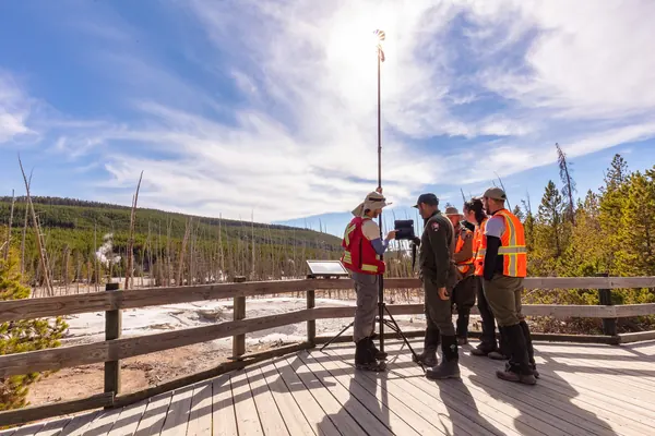
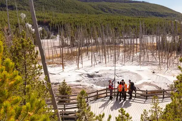
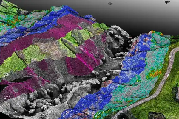
Illustrative photos, published by their authors under free licences.
Contents of the complete guide
- Photogrammetry or not: the decision table before any flight plan (free extract below)
- GSD and flying height: the formula and full calculations
- The flight plan: overlaps, lines, timing, nadir, oblique and façades
- Georeferencing: French legal system, ground control, check points, RTK and PPK
- Preparing the mission: the flight rules on one page, and where to read them
- Acquisition on site: light, wind, settings and checklist
- Processing: the generic chain and its hold points
- Accuracy checks: RMSE, the French 2003 accuracy classes, ASPRS standards
- Deliverables, formats and processing report
- Volumes: how to compute them, and their limits
- Common mistakes, from quote to delivery
- Six templates to copy
- Sources and consultation dates
Included: 19 checklist items and 19 decision or reference tables.
Introduction
A drone photogrammetry survey rarely fails on processing day. It fails earlier: a flying height chosen out of habit that misses the promised resolution on sloping ground, overlaps too tight along a wood, a purely vertical flight plan that makes the model bulge in the middle, ground control points all lined up along the access road, no independent check points, heights delivered above the ellipsoid instead of in the French levelling datum. The software still produces a sharp orthomosaic and a flattering report. The error only shows when the surveyor overlays the survey on their plan, when the engineer computes a volume, or when the client compares two campaigns.
This guide sets out the complete method, from choosing the sensor to signing the delivery record, for a survey flown in France. It is written for those who produce surveys (drone operators, surveyors, quarry and contractor teams) and for those who commission and must check them, including foreign firms working to French requirements. Each step is worked through with the actual calculation (flying height, photo base, line spacing, motion blur, accuracy class thresholds), and it ends with six templates ready to fill in.
The guide is up to date as of 31 October 2026: texts reread on that date, studies checked through their DOI. The legal side of the trade (ZICAD data-capture bans, large areas, data ownership) is covered by the "Drone surveying and mapping" trade edition; managing construction monitoring as a client is covered by the "Construction monitoring by drone" guide.
Photogrammetry or not: the decision table before any flight plan
What photogrammetry actually measures
Photogrammetry measures no distances. It finds the same details in hundreds of overlapping photos taken from different positions, and computes from them the position of each camera station and the 3D position of each detail. Everything it produces follows from that: a point only exists in the model if it is visible, textured and seen from at least two positions (in practice many more).
Three practical consequences:
- It sees the surface, not the ground under vegetation. Under trees or tall scrub, the model shows the top of the canopy. A digital terrain model (DTM) under woodland is not a photogrammetric deliverable.
- It needs texture. Plain metal roofing, smooth render, water, snow, glass or fresh uniform asphalt give few matching points, hence holes or noise.
- It needs stable light. Moving shadows, passing clouds and backlight change the look of the same surface from one image to the next and degrade matching.
In return, one flight yields an orthomosaic, a surface model and a textured 3D model with an ordinary camera. On well-textured mineral surfaces (quarries, earthworks, roads, tiled roofs, stone façades) it is often the most economical route to checked centimetre-level accuracy.
The decision table
| Survey situation | Photogrammetry | Better or complementary |
|---|---|---|
| Bare ground, quarry, earthworks, stockpile | Suitable | Ground control and check points, or RTK/PPK plus check points |
| Orthomosaic of a town, business park, farm parcel | Suitable | Nadir only is usually enough |
| Façade, monument, bridge | Suitable, with oblique or frontal images | Terrestrial laser scanning for hidden or interior parts |
| Ground under vegetation (woods, hedges, scrub) | Unsuitable for the ground | Drone LiDAR, or ground survey |
| Power lines, cables, thin elements | Unsuitable (too thin to match) | LiDAR |
| Uniform surfaces, water, snow, glazing | Difficult | LiDAR, or artificial targets where possible |
| Building interiors, tunnels, under a bridge | Unsuitable for GNSS-guided flight | Static or mobile laser scanning |
| Millimetre deformation monitoring | Rarely enough on its own | Conventional monitoring survey, photogrammetry as visual support |
The site's free guides cover the two most common trade-offs: drone LiDAR or photogrammetry and drone photogrammetry or terrestrial laser scanning.
The four values to fix before talking about drones
A survey is defined by four values, written down before the first flight; confusing them is behind most disputes.
- Ground sampling distance (GSD): the size of one pixel on the ground. It decides what detail is visible. It says nothing about position.
- Target accuracy, separately in planimetry (x, y) and height (z), measured on independent check points. It decides what can be measured.
- The coordinate reference system, in three parts: geodetic system, map projection, height datum. It decides what can be overlaid.
- Deliverables and formats: orthomosaic, point cloud, DSM, DTM, mesh, drawing, volumes. They decide what the client can open and use.
A fine GSD does not imply good accuracy, and good accuracy is useless in the wrong system. To fix them, ask the client one question first: "What will you measure or decide with this file, and in which software?" The rest of this guide takes the four values in the order they come up on site.
How it works
- You pay on StripeBy card, Apple Pay or Google Pay, in one go, on the checkout page hosted by Stripe: your card details never go through our servers.
- You read it right awayRight after payment, you land on the complete guide's page. Bookmark it or print it to PDF; the link and the invoice are emailed to you, and everything stays findable with “Find my purchases”, at the bottom of every page.
- Guaranteed contentAs described, or your money back: email devis@c-drone.fr and we restore access or refund you (terms of sale, in French).
Frequently asked questions
What does “Drone photogrammetry in France: the method, from flight plan to checked deliverable” contain and how much is it?
For €39 VAT included (€32.50 excl. VAT), you get drone photogrammetry in France: the method, from flight plan to checked deliverable: 12 chapters online, about 31 printable A4 pages and 6 ready-to-copy templates, to produce or commission a drone photogrammetry survey in France that delivers what it promises: decide whether photogrammetry is the right sensor, work out flying height from the required ground sampling distance, set overlaps and camera angles, georeference in the French legal reference system (RGF93, Lambert-93, NGF-IGN69) with ground control points, independent check points, RTK or PPK, run acquisition and processing, measure accuracy on check points against the French accuracy classes of the Order of 16 September 2003 and the ASPRS standards, and deliver the right formats with a verifiable report.
How do I receive the guide?
Right after payment you are redirected to the complete guide's page. Bookmark it, or print it to PDF (Ctrl+P or Cmd+P, “Save as PDF”). Stripe also emails you the receipt.
Do I get an invoice?
Yes: Stripe generates the invoice and emails it. You can enter your company name and VAT number at checkout. Seller: Lacangel Group (VAT FR21995268018); prices VAT included.
Is the guide kept up to date?
Yes. The guide's page is updated when the rules change; your access stays valid and you always read the latest version.
Which texts is the guide based on?
On the official texts in force (EU regulations, French decrees and codes), cited and dated with their links: you can check every rule at its source, which is authoritative. C-DRONE is an independent publisher.
Which device can I read it on?
Computer, tablet or phone: it is a web page, with no app or account to create. Print it to PDF to archive it or share it within your team.
What guarantee do I get?
The content matches its description, or you get your money back: email devis@c-drone.fr and we restore access or refund you (terms of sale, in French). This also applies to business purchases.
Other guides
New Drone light show guide
Organising a drone light show in France: budget, permits, contract
Town, company or wedding: check whether your project works, file the prefecture application on time, compare quotes, sign a contract that deals with the weather and run the night itself
€29 incl. VAT · €24.17 excl. VAT · 11 chapters · instant access
New CATS exam prep
Passing the French CATS drone exam: course and 104 practice questions
The eight subjects of the official DGAC syllabus summarised, 64 answered and explained questions, a 40-question mock exam and a four-week revision plan, with the French terms you will meet
€24 incl. VAT · €20.00 excl. VAT · 11 chapters · instant access
New Thermography guide
Drone thermography in France: commission, check and use the report
Roofs, facades, flat roofs, solar PV: choose the right measurement window, write the specification, check the flight conditions, read the report in fifteen minutes and turn it into repair decisions
€29 incl. VAT · €24.17 excl. VAT · 11 chapters · instant access
Free articles on the topic
- Drone photogrammetry: how much does a 3D model cost?
- Ground sampling distance (GSD) in drone photogrammetry: choosing it project by project, price
- RTK or PPK drone: what centimetre accuracy is for and when to require it
- Checking a Drone Photogrammetry Deliverable: Processing Report, Check Points, Tolerances
- Drone photogrammetry deliverables: orthophoto, DSM/DTM, point cloud, 3D mesh
- Drone photogrammetry software: 2026 comparison (free and paid)
Instant access to your guide after payment · terms of sale (in French). Questions before buying: devis@c-drone.fr.