POWER LINE CLEARANCE GUIDE · UPDATED NOVEMBER 2026
Power lines and vegetation clearance by drone in France: distances, LiDAR survey and specification
New
For €39 VAT included (€32.50 excl. VAT): a guide to have a drone measure, and then use, the clearance between a French overhead power line and vegetation or obstacles.
After payment
- The page after payment shows the link to your guide: you start reading right away.
- An email from C-DRONE (no-reply@tech-bharat.com) sends you this link again with your order details (amount, VAT, order number).
- Find my purchases gives you your links back at any time.
- No phone calls: nobody will ring you.
Guarantee: content as described, or your money back
For €110 more, the complete library: all 48 guides, this one included →
VAT included (€32.50 excl. VAT) · secure Stripe payment (card, Apple Pay, Google Pay) · terms of sale (in French)
What you get
- The online guide: 9 chapters, about 32 A4 pages, printable to PDF
- 6 ready-to-copy templates: clearance survey specification · deliverable checklist · deliverable non-conformity register · letter to the network operator · field checklist · clearance survey report outline · and 2 more
- For: Local authorities, energy syndicates and road or forest managers · Engineering firms, surveyors and drone operators, French or foreign,
- Delivery: instant online access right after payment; Stripe invoice by email
- Preview: the whole first chapter, free, further down this page
9chapters
32printable A4 pages
6templates to copy
30checklist items
Checked at the source
Reviewed by industry professionals. Every rule links to its text.
322links to official texts across our guides
77automated checks before every release
November 2026latest revision of this guide
- Primary sources: Légifrance, Géoportail.
- Every figure linked to its source, dated in the last chapter.
- Dated updates: you always read the latest version.
Who it is for
- Network operators, local distribution companies and industrial sites with a private line, who want a section checked between two maintenance campaigns
- Local authorities, energy syndicates and road or forest managers who need the facts on trees near a line before discussing them with the operator
- Tree surgery and forestry contractors preparing works under or near a line who must locate, classify and mark trees
- Forest owners, farmers and site operators (quarries, logistics yards, campsites) crossed by a line
- Engineering firms, surveyors and drone operators, French or foreign, who deliver these surveys in France and want a report that holds up
In pictures
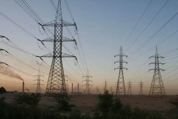
Illustrative photos, published by their authors under free licences.
Contents of the complete guide
- Three distances, three responsible parties: what the survey must settle (free extract below)
- The distances of the order of 17 May 2001: work them out yourself
- Conductor sag and temperature: why the flight day is not enough
- Trimming duties in France: operator, owner, local authority, contractor
- Preparing the works: DT-DICT, informing the operator and worker safety
- Commissioning the clearance survey: LiDAR or photogrammetry, parameters and deliverables
- Accepting the deliverable: tolerances, point cloud and report
- From survey to trimming works: priorities, marking and post-works check
- Six templates to copy
- Sources and dates of consultation
Included: 30 checklist items and 10 decision or reference tables.
Introduction
A tree too close to a power line rarely starts as a measurement question. It starts as a question of responsibility: who must cut, at what distance, by when, at whose expense, and with what precautions for the people cutting. Measurement comes next, and that is where drone surveys most often disappoint: a beautiful point cloud, a red, amber and green map, and nobody knows which regulatory distance red stands for, at what conductor temperature the distance was computed, or with what uncertainty. The report does not hold up with the network operator, and the trimming works are planned on a list no tree surgeon dares to follow.
This guide gives those who commission the survey in France, and those who deliver it, the method that is missing. It separates the three distances that circulate and get confused (the asset's, the tree worker's, the operator's maintenance distance), shows how to calculate yourself the minimum distances of the French order of 17 May 2001 for each voltage, explains why conductor sag changes with temperature and what that requires from the survey, then sets out who must trim, how works are prepared with the DT-DICT declaration and the rules of the order of 5 July 2024, how to choose between LiDAR and photogrammetry along a corridor, and how to accept the point cloud and report against a decision rule written in advance. It ends with six templates: specification, deliverable checklist, non-conformity register, letter to the network operator, field checklist and report outline.
The guide is up to date as of 7 November 2026. The articles of the orders of 17 May 2001 and 5 July 2024 and article R4544-24 of the Labour Code were read that day on Légifrance, in their current versions. French legal terms are kept where they matter (DT-DICT, consignation), with an explanation. The worked examples are recalculated in the text with their assumptions written out: redo them with your line's data. Read it in order the first time; afterwards, chapter 2 (distances), chapter 7 (acceptance) and the templates are enough for each campaign.
Three distances, three responsible parties: what the survey must settle
The asset's distance, the worker's distance, the maintenance distance
Along a French overhead line, "safety distance" covers three rules that have neither the same purpose, nor the same addressee, nor the same values. Confusing them is the most common mistake in specifications, and it is enough to make a survey unusable.
The asset's distance. The order of 17 May 2001 sets the technical conditions that electricity distribution installations must meet in France. Its article 26 deals with proximity to trees, structures not normally accessible to people and cliffs: it says how far the conductor must stay from vegetation, under precise temperature and wind conditions. It binds the line operator, who must respect it at all times.
The worker's distance. Since 19 December 2024, article R4544-24 of the French Labour Code requires employers to ensure that workers, equipment, vehicles and handled loads do not cross safety distances set by voltage near a bare overhead line. The order of 5 July 2024 sets the figures, and adds distances specific to vegetation work. It binds the contractor who trims, fells or clears, and any employer whose staff work near the line.
The maintenance distance. To avoid coming back every year, operators trim well beyond the asset's minimum. The guide on vegetation management under and near power lines, written by RTE (transmission), Enedis (distribution) and the organisations representing forest owners, chambers of agriculture and contractors, states that the distances of the technical order are a floor and that the cleared strip is negotiated beyond it to last between two cuts, every three to five years on average. It depends on the operator's practice and on the easement agreement, not on a national figure.
| Distance | Text | Who must respect it | What it measures | Values |
|---|---|---|---|---|
| Asset | Order of 17 May 2001, articles 12 and 26 | Line operator | Conductor ↔ tree, under reference conditions | Calculated by voltage (chapter 2), at least 2 m for bare high-voltage lines |
| Worker | Labour Code R4544-24, order of 5 July 2024 | Employer of anyone working near the line | Line ↔ worker, tool, machine, load, vegetation being worked on | 3 m or 5 m in general; 2 to 5 m between the line and vegetation being worked on |
| Maintenance | Easement agreement, operator practice | Operator and its tree contractor | Width or distance to which vegetation is cut | Specific to each operator and line |
A clearance survey serves all three rules, but it does not measure them the same way. The asset's distance is checked with the conductor at its maximum temperature, so after calculation. The worker's distance is checked on the real position of the cable on the day of the works. The maintenance distance is read on a plan. The specification must say which one is required, or all three.
Who commissions this survey, and why
The network operator and its contractors commission a targeted check between campaigns, a post-storm assessment, a check after works or a prioritisation of areas to trim. Only the operator knows the maximum temperature adopted for each conductor and the current carried.
A local authority commissions to establish the facts: street trees or municipal woods near a line, a resident's complaint, preparation of a discussion with the operator. It is then an owner like any other, with the same rights and the same liability as keeper of its trees.
The tree contractor needs a list of classified, located and markable trees, with the cable height and the vegetation distance, to decide the method (directional felling, dismantling, outage) before arriving on site.
The owner or operator of a site crossed by a line (private forest, farm, quarry, logistics yard) wants to know which of its trees are concerned and to document the state of the corridor on a given date.
The industrial owner of a private site line is its own operator: nobody will do the check for it.
What a drone measures, and what it does not
A drone survey, usually LiDAR, measures geometry: the position in space of conductors, supports, ground and vegetation on the day and at the time of the flight. With correct processing, it derives, span by span, the curve of each conductor and the minimum distance between that curve and each tree.
It does not measure the conductor temperature, which nonetheless drives its position; it does not measure the current carried; it says nothing about the mechanical condition of the cable (broken strands, corrosion, a hot joint), which is a matter for visual and thermal inspection; it does not say who owns a tree, which is read on the land register and in the easement agreement; and it delivers no compliance opinion: it is a technical exhibit feeding the operator's decision, never the decision itself.
What published measurements show
The processing chain has been documented for twenty years. A review by Leena Matikainen and seven co-authors, published in 2016 in the ISPRS Journal of Photogrammetry and Remote Sensing, reviews the data sources used to monitor power line corridors (radar, optical and thermal images, airborne laser scanning, mobile mapping, drones). It finds that automated conductor extraction is the most studied topic, with success rates above 90% reported on airborne laser scanning data or aerial images, but often on small datasets and without numerical quality analysis, and it calls for tests in real conditions with careful quality control (doi:10.1016/j.isprsjprs.2016.04.011). That is the purpose of chapter 7: a processing result is checked, not assumed. The study closest to a drone service is by Chi Chen, Bisheng Yang, Shuang Song, Xiangyang Peng and Ronggang Huang, published in 2018 in Remote Sensing: from drone LiDAR point clouds, it filters the ground, detects towers, splits the line into spans, fits a catenary to each conductor and computes the minimum distance to each object, with a reported accuracy in the order of a decimetre on the authors' datasets (doi:10.3390/rs10040613). That decimetre is the right scale for discussion: enough to spot an out-of-tolerance point, not enough to settle a difference of a few centimetres. Chapter 7 turns it into a decision rule.
Five minutes to classify your need
| Your situation | Distance to check | Main deliverable | Useful chapters |
|---|---|---|---|
| Trees reported near a line, you want to know whether it is urgent | Asset (and worker if works follow) | List of classified trees with extrapolated distances | 2, 3, 7 |
| You are preparing trimming or felling works | Worker | List of trees to mark, real cable height, likely outage zones | 2, 5, 8 |
| Earthworks, a building or a stockpile built under the line | Asset (article 100 of the 2001 order) | Conductor ↔ ground and obstacle distances | 2, 3, 6 |
| Multi-year monitoring of a wooded corridor | Maintenance and asset | Comparison of two campaigns, projection by species | 6, 7, 8 |
| Private site line | All three | Full report and inspection register | The whole guide |
How it works
- You pay on StripeBy card, Apple Pay or Google Pay, in one go, on the checkout page hosted by Stripe: your card details never go through our servers.
- You read it right awayRight after payment, you land on the complete guide's page. Bookmark it or print it to PDF; the link and the invoice are emailed to you, and everything stays findable with “Find my purchases”, at the bottom of every page.
- Guaranteed contentAs described, or your money back: email devis@c-drone.fr and we restore access or refund you (terms of sale, in French).
Frequently asked questions
What does “Power lines and vegetation clearance by drone in France: distances, LiDAR survey and specification” contain and how much is it?
For €39 VAT included (€32.50 excl. VAT), you get power lines and vegetation clearance by drone in France: distances, LiDAR survey and specification: 9 chapters online, about 32 printable A4 pages and 6 ready-to-copy templates, to have a drone measure, and then use, the clearance between a French overhead power line and vegetation or obstacles: work out yourself the minimum distances of the order of 17 May 2001, understand why conductor sag changes with temperature and what that requires from the survey, know who must trim and on what terms, prepare the works with the DT-DICT declaration and the rules of the order of 5 July 2024, choose between LiDAR and photogrammetry for a corridor, then accept the point cloud and report against a decision rule written in advance.
How do I receive the guide?
Right after payment you are redirected to the complete guide's page. Bookmark it, or print it to PDF (Ctrl+P or Cmd+P, “Save as PDF”). Stripe also emails you the receipt.
Do I get an invoice?
Yes: Stripe generates the invoice and emails it. You can enter your company name and VAT number at checkout. Seller: Lacangel Group (VAT FR21995268018); prices VAT included.
Is the guide kept up to date?
Yes. The guide's page is updated when the rules change; your access stays valid and you always read the latest version.
Which texts is the guide based on?
On the official texts in force (EU regulations, French decrees and codes), cited and dated with their links: you can check every rule at its source, which is authoritative. C-DRONE is an independent publisher.
Which device can I read it on?
Computer, tablet or phone: it is a web page, with no app or account to create. Print it to PDF to archive it or share it within your team.
What guarantee do I get?
The content matches its description, or you get your money back: email devis@c-drone.fr and we restore access or refund you (terms of sale, in French). This also applies to business purchases.
Other guides
New Drone light show guide
Organising a drone light show in France: budget, permits, contract
Town, company or wedding: check whether your project works, file the prefecture application on time, compare quotes, sign a contract that deals with the weather and run the night itself
€29 incl. VAT · €24.17 excl. VAT · 11 chapters · instant access
New CATS exam prep
Passing the French CATS drone exam: course and 104 practice questions
The eight subjects of the official DGAC syllabus summarised, 64 answered and explained questions, a 40-question mock exam and a four-week revision plan, with the French terms you will meet
€24 incl. VAT · €20.00 excl. VAT · 11 chapters · instant access
New Thermography guide
Drone thermography in France: commission, check and use the report
Roofs, facades, flat roofs, solar PV: choose the right measurement window, write the specification, check the flight conditions, read the report in fifteen minutes and turn it into repair decisions
€29 incl. VAT · €24.17 excl. VAT · 11 chapters · instant access
Free articles on the topic
- Conductor clearance survey by drone LiDAR: sag, temperature and regulatory distances
- Vegetation Clearance Along High-Voltage Power Lines: What a Drone LiDAR Survey Documents
- Vegetation mapping under power lines by drone LiDAR: the legal clearance obligation and price
Instant access to your guide after payment · terms of sale (in French). Questions before buying: devis@c-drone.fr.