A professional drone pilot for this mission Request a free quote
C-DRONE GUIDE · 17 JUNE 2026
Drone construction monitoring: price and ideal frequency
A drone visit to a construction site costs between €320 and €690 in 2026, and full monitoring over the life of a project represents an annual budget of €5,000 to €15,000. For project owners and developers, the real question is not the price of a flight but the rhythm: what visit frequency documents the site without paying for useless flights? Here are the prices, the packages and the frequencies that work.
Published on 17 June 2026, updated on 13 October 2026 — regulations in force as of September 2026.
2026 prices: per visit or as a package
Drone construction monitoring is sold in two forms. The single visit, between €320 and €690 depending on site size and deliverables: the formula for one-off needs — pre-works site survey, milestone record, photos for a steering committee. And the recurring package, which commits the operator for the duration of the project with a decreasing unit price: the formula of developers and major contractors, with annual budgets of €5,000 to €15,000 depending on frequency and site size.
| Formula | Observed 2026 price | For which site |
|---|---|---|
| Single visit (photos + flyover video) | €320 – 450 | House, small block, one-off record |
| Single visit with georeferenced orthophoto | €450 – 690 | Earthworks, utilities, crane logistics |
| Monthly package (12 visits/year) | €280 – 420/visit, i.e. €3,400 – 5,000/year | Residential, offices, 12-24 months of works |
| Fortnightly package (24 visits/year) | €250 – 380/visit, i.e. €6,000 – 9,000/year | Large operation, fast phases |
| Full monitoring of a major project (visits + orthophotos + timelapse) | €10,000 – 15,000/year | Urban development zone, hospital, industrial site |
The package cuts the unit price by 20 to 30%: the pilot reuses their flight plan, authorisations and processing parameters from one visit to the next. It also guarantees image comparability — same axes, same altitudes, same focal length — without which monitoring loses most of its documentary value.
What providers publish (checked on 13 October 2026)
Few providers show a construction-monitoring price on the first page of Google: most point to a quote or to “monthly packages with commitment discounts”. Among those who do, one pilot states that a monitoring visit “is typically negotiated between €500 and €900 excl. VAT for a photo mission, travel included” (checked on 13 October 2026). That is the top of our single-visit range: the gap comes from included travel and no commitment. To get the low end, present a visit schedule over the project's duration and have the quote state the delivery time, identical camera angles at every visit and the cost of options (orthophoto, volumes).
The ideal frequency, phase by phase
Paying for a weekly visit during fit-out is wasted money; paying for only one per quarter during earthworks is too. The right frequency follows how fast the site changes face when seen from the sky.
- Before site opening: one baseline visit, essential. This is the zero state that protects you in disputes with neighbours (cracks that "appeared" during the works) and documents existing conditions.
- Earthworks and utilities (2-4 months): one visit every two weeks, with an orthophoto. This is when the drone delivers the most measurable value: cut-and-fill volumes, footprint control, stockpile management.
- Structural work (6-12 months): a monthly visit is enough — the building gains a floor every three to four weeks, and the image rhythm naturally follows the payment-application cycle.
- Weathertight shell and fit-out: one visit every six to eight weeks; from the sky little happens, but the images keep feeding sales communication.
- Handover: a final, carefully lit visit — the one that will serve for years in brochures and the company's references.
On a typical 18-month operation, this rhythm gives 16 to 20 visits, i.e. €5,000 to €8,000: less than 0.1% of the construction cost of a 30-unit residential building, for complete documentation of the operation.
What a visit includes (and does not)
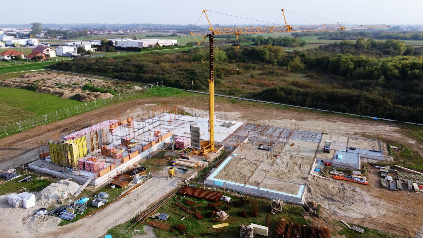
A standard visit includes the flight along the plan defined on the first visit, a series of high-definition photos along the same axes every time, a one-to-two-minute flyover video, and delivery within 48 hours via a sharing platform — site managers review Monday's images at Tuesday's site meeting. The georeferenced orthophoto, point cloud and volume calculations are options billed €100 to €250 per visit, as they add photogrammetric processing time.
Generally not included: the préfecture declaration if the site is in a built-up area (€80 to €200 per file, but a well-built declaration can cover several visits over consecutive slots — insist on that optimisation), emergency off-schedule visits (damage event, dispute, ministerial visit: expect the unit price plus 20 to 40%), and the end-of-project film compiling all the visits (€500 to €1,500, to be ordered from the start so the shots are designed for it). For advanced metrological uses — BIM models, design-to-built comparison, topographic monitoring — our technical guide photogrammetry and BIM on construction sites details the methods and achievable accuracy.
The return on investment for the project owner
Drone monitoring pays for itself through four channels, in the order of importance we observe among our developer clients. Evidence first: in a dispute — with a neighbour, a trade contractor, an insurer — having dated, comparable images of every stage is often worth tens of thousands of euros; it is the operation's documentary insurance. Steering next: on large footprints, the fortnightly orthophoto reveals setting-out drift, misplaced stockpiles and co-activity zones nobody sees from the site office. Sales communication: aerial images feed sales suites and social media and reassure buyers about progress — a use that alone justifies the package for many developers. Finally, company memory: the end-of-project film becomes a commercial reference for the next tenders.
One contractual point of care: ownership and retention of the images. Require a rights assignment covering all your uses (internal, commercial, press) and retention of source files for at least the duration of the ten-year structural warranty — some disputes wake up late, and the photo of the rebar before pouring taken in March 2026 can be worth a great deal in 2033. The full course of a mission is described on our drone construction monitoring page.
Urban sites: what regulation changes in the schedule
Most multi-unit residential sites are in built-up areas, and that structures the monitoring contract. Since 1 January 2026 (order of 23 December 2025), professional open-category flight over public space in built-up areas is allowed — daytime, no overflight of people — which has simplified many site-monitoring missions; but every flight remains subject to a préfecture declaration with ten working days' notice (cerfa form 15476*04). In practice: a package's visits are declared in planned batches, and "a visit tomorrow morning because the regional director is coming" does not legally exist in town without anticipation.
The site footprint itself works in your favour: fenced and under the contractor's control, it is an area from which third parties are excluded, which makes flights over the plot easier. The constraints concentrate on the surroundings — the neighbour's crane, the adjoining school, the bus corridor. Check that your operator is registered as a UAS operator, carries aerial liability insurance (an obligation under Regulation EC 785/2004) and, for dense urban configurations requiring the specific category, operates under scenario STS-01 with a CATS-certified pilot. It is these requirements — not the drone — that explain why serious site monitoring never drops below €250 per visit.
Frequently asked questions about drone site-monitoring prices
How much does drone construction monitoring cost? From €320 to €690 per single visit depending on deliverables, and €5,000 to €15,000 per year as a recurring package. A monthly package on an 18-month operation typically works out at €280-420 per visit.
What is the right visit frequency? Fortnightly during earthworks, monthly during structural work, every six to eight weeks after that, plus a baseline visit before site opening and a handover visit. Around 16 to 20 visits for an 18-month operation.
Can the drone fly over the workers? No: overflight of people is prohibited in the open category. The pilot flies over clear areas, outside peak activity or during breaks, and coordinates visits with the crane schedule.
Is an authorisation needed for every urban visit? Every flight in a built-up area must be covered by a préfecture declaration filed ten working days in advance, but a single declaration can cover several planned slots — one of the advantages of a package.
Put it into practice
- Drone construction site monitoring: rates and cities covered from €250
- Construction site monitoring in Grenoble Auvergne-Rhône-Alpes
- Construction site monitoring in Brest Bretagne
- Construction site monitoring in Metz Grand Est