RAILWAY, ROAD AND MOTORWAY GUIDE · UPDATED NOVEMBER 2026
Drones near railways, roads and motorways in France: permissions, coordination with the infrastructure manager and level crossings
New
For €39 VAT included (€32.50 excl. VAT): a guide to prepare a drone mission along or above a railway, a road or a motorway in France.
After payment
- The page after payment shows the link to your guide: you start reading right away.
- An email from C-DRONE (no-reply@tech-bharat.com) sends you this link again with your order details (amount, VAT, order number).
- Find my purchases gives you your links back at any time.
- No phone calls: nobody will ring you.
Guarantee: content as described, or your money back
For €110 more, the complete library: all 48 guides, this one included →
VAT included (€32.50 excl. VAT) · secure Stripe payment (card, Apple Pay, Google Pay) · terms of sale (in French)
What you get
- The online guide: 10 chapters, about 34 A4 pages, printable to PDF
- 8 ready-to-copy templates: pre-assessment sheet for a site next to infrastructure · coordination request to a railway infrastructure manager · operation request to a motorway operator · cover letter for a parking permit application · temporary traffic order request · level crossing survey programme sheet · briefing sheet beside the tracks · mission report to the manager · and 4 more
- Delivery: instant online access right after payment; Stripe invoice by email
- Preview: the whole first chapter, free, further down this page
10chapters
34printable A4 pages
8templates to copy
17checklist items
Checked at the source
Reviewed by industry professionals. Every rule links to its text.
322links to official texts across our guides
77automated checks before every release
November 2026latest revision of this guide
- Primary sources: Légifrance, EUR-Lex, Géoportail, DGAC, service-public.fr, EASA.
- Every figure linked to its source, dated in the last chapter.
- Dated updates: you always read the latest version.
Who it is for
- Drone operators and remote pilots, French or foreign, flying near a French railway, road or motorway: bridges and structures, adjacent construction sites, corridor surveys, traffic counts, inspections
- Engineering firms, surveyors and project managers commissioning a survey next to transport infrastructure in France
- Road departments of French municipalities, inter-municipal bodies and départements that must produce the safety assessment of their level crossings or commission a flight on their network
- Contractors and project owners whose site borders a railway or motorway corridor
In pictures
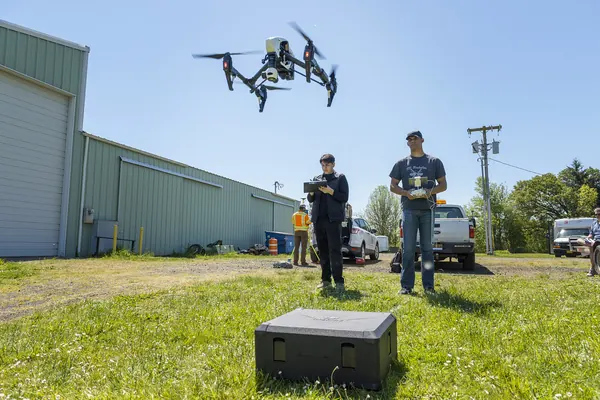
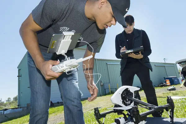
Illustrative photos, published by their authors under free licences.
Contents of the complete guide
- Railways, roads, motorways: what the texts actually require in 2026 (free extract below)
- Finding the infrastructure manager and the competent authority
- Choosing the operating framework along infrastructure
- Coordinating with the rail infrastructure manager: request, conditions, lead times
- Roads and motorways: road occupation, traffic orders, closures
- Level crossings: preparing and running the survey for the safety assessment
- Flight day beside the tracks: safety, incidents, report
- Commissioning the mission: what the client requires and checks
- The decision tree: which step, what lead time
- Eight templates to copy
- Sources and dates consulted
Included: 17 checklist items and 13 decision or reference tables.
Introduction
Next to a railway or a motorway, a drone mission rarely fails in the air. It fails before: an infrastructure manager contacted too late, a request that does not say where or when, a crew that finds out the day before that it cannot set foot on the verge, a remote pilot who applies a 30 m rule that has left the texts and forgets the ones that matter. And when it does fail in the air, the consequences go well beyond the mission: a drone on the tracks or in the overhead line stops trains, a drone falling on a live carriageway can cause a crash.
This guide sets out the full method for the operator flying near French transport infrastructure and for the client commissioning the mission. It starts from what the texts say on 5 November 2026, including a clarification that many pages still miss: the 30 m distance from railways and motorways came from the French national standard scenarios, which civil operators can no longer use since 1 January 2026. It then explains who manages which line or road, which operating framework to choose, how to obtain rail coordination, road occupation and traffic orders, how to run the survey of a level crossing for its safety assessment, and how to behave beside the tracks. It ends with a decision tree and eight ready-to-fill templates.
The guide is up to date as of 5 November 2026. The French texts cited were re-read that day on Légifrance and the European texts on EUR-Lex and the EASA website. French texts are only authoritative in French, and French infrastructure managers and authorities work in French: the French terms you will need are given in brackets, and the templates should be sent in French. Read it in order the first time; afterwards, chapter 9 (the decision tree) and the templates are enough for each new mission.
Railways, roads, motorways: what the texts actually require in 2026
The 30 m rule: where it comes from, who it still applies to
You will read everywhere that a drone must not fly within 30 m of a railway without coordinating with its manager, nor within 30 m of a motorway unless it is closed. Both sentences do exist. They sit in the annex to the French order of 3 December 2020 defining the national standard scenarios, in paragraphs 3.6.7 and 3.6.8, among the flight conditions of scenarios S-1, S-2 and S-3:
- the aircraft does not fly at a horizontal distance of less than 30 metres from a motorway or an expressway, except when it is closed to traffic ("neutralisée");
- the aircraft does not fly at a horizontal distance of less than 30 metres from a railway open to rail traffic, except with coordination between the operator and the manager of the line concerned.
Civil operators can no longer use these national scenarios since 1 January 2026: they have given way to the European standard scenarios STS-01 and STS-02 and to specific category authorisations. The scenarios order, in its version of 5 February 2026, now only covers activities excluded from Regulation (EU) 2018/1139, that is State and similar missions (police, customs, rescue, firefighting and so on), which it allows to operate under those conditions until 31 December 2027.
The French order of 3 December 2020 on the use of airspace, known as the "Espace" order, which applies to every civil flight, contains no minimum distance from a railway, a road or a motorway in its version in force on 1 January 2026. Regulation (EU) 2019/947 does not either.
Several official pages, including some prefecture pages, still reproduce the S-3 scenario conditions without saying they no longer apply to civil flights. If someone quotes them to you, do not argue the principle: the caution they express is still expected, and it is the basis on which your agreement with the manager will be built.
What applies instead: four sources of obligations
The disappearance of the written rule does not free the flight. Four sets of obligations, more demanding in practice, replace it.
1. The rules of your operating category towards people. Regulation 2019/947 reasons in terms of uninvolved persons. EASA guidance material (GM1 Article 2(18), as amended by ED Decision 2022/002/R and unchanged in the June 2026 Easy Access Rules) makes two points that matter next to infrastructure: people walking in a street or on a road are generally uninvolved persons; people protected by a shelter, such as a roof, are not considered exposed to direct risks if the drone's maximum take-off mass is below 25 kg. Passengers in a train or a closed car fall into the second case; pedestrians, cyclists, motorcyclists, track workers and road crew stay in the first.
That reading of the guidance says nothing about indirect risk: a drone that falls on a live carriageway, lands on a track or touches an overhead line can cause a crash or stop traffic, even if nobody is hit. That is the risk the manager, the insurer and, in the specific category, the authority will look at.
2. The ground. The remote pilot cannot fly from just anywhere. Article L2242-4 of the French Transport code punishes with six months' imprisonment and a €3,750 fine entering, moving or standing without proper authorisation in parts of the railway or its outbuildings that are not open to the public. Article R421-2 of the Highway code bars pedestrians from motorways. And taking off from a verge, a pavement or a public car park means occupying public land: article L2122-1 of the General code of public property requires a permit for any occupation beyond ordinary public use.
3. Airspace rules. Prohibited, restricted and danger areas, controlled airspace, sensitive sites, night and populated areas (prior declaration to the prefecture) apply beside a track as anywhere else. A city-centre station, an interchange on the edge of a town or a viaduct over an inhabited valley often combine several of them. The drone restrictions map on Géoportail shows airspace restrictions; a railway or motorway does not appear on it as a zone in itself.
4. The manager's conditions. The infrastructure manager does not issue a flight authorisation in the aviation sense. But it controls access to its land, alone decides to close a lane or stop traffic, can require its staff to escort you, and knows risks the remote pilot does not (train times, ongoing works, electrical installations, security zones). As soon as the mission needs it, its written conditions set the date and the method.
The common situations at a glance
| Situation | What applies in practice | Main step |
|---|---|---|
| Flight more than 30 m from a railway, take-off on private land, nothing above the tracks | Category rules, airspace | Landowner's consent; informing the manager is advisable for long flights |
| Flight within 30 m of a railway or above the tracks | Risk of falling onto the track, overhead line, trains | Written coordination with the rail manager |
| Take-off, landing or crew inside the railway corridor | No entry without authorisation (L2242-4) | Access permission and safety conditions from the manager, prevention plan |
| Flight beside a road, crew off the carriageway, take-off on private land | Uninvolved persons (pedestrians, cyclists), driver distraction | Flight plan that does not overfly the live carriageway |
| Crew or vehicle on the verge, pavement or public car park | Occupation of public land | Parking permit from the road authority |
| Flight over a live road | Uninvolved road users, risk of falling on the carriageway | Closure by the road authority, temporary traffic order, or specific category |
| Any operation from a motorway | Pedestrians banned (R421-2), road operated by a concession company or the State | Request to the operator, time slot, escort |
| Level crossing survey | Both regimes overlap | Rail and road coordination, within the safety assessment |
| Mission in a built-up area (urban station, town bridge) | Populated area | Prior declaration to the prefecture on top of the rest |
Five minutes to classify a site
- Open the Géoportail restrictions map and note the airspace zones involved.
- Measure on an aerial view the distance between the flight area, its buffer and the nearest track or live carriageway.
- Locate the take-off point: private land, public road land, railway corridor, motorway corridor.
- Identify the line or road: railway line (number, kilometre point, numbered level crossing), road (municipal, departmental, national, motorway under concession or not).
- Note whether the site is in a built-up area and whether people will be within 150 m.
With these five answers, the decision tree in chapter 9 gives the list of steps and the realistic lead time. Template 1 puts these questions in a table.
How it works
- You pay on StripeBy card, Apple Pay or Google Pay, in one go, on the checkout page hosted by Stripe: your card details never go through our servers.
- You read it right awayRight after payment, you land on the complete guide's page. Bookmark it or print it to PDF; the link and the invoice are emailed to you, and everything stays findable with “Find my purchases”, at the bottom of every page.
- Guaranteed contentAs described, or your money back: email devis@c-drone.fr and we restore access or refund you (terms of sale, in French).
Frequently asked questions
What does “Drones near railways, roads and motorways in France: permissions, coordination with the infrastructure manager and level crossings” contain and how much is it?
For €39 VAT included (€32.50 excl. VAT), you get drones near railways, roads and motorways in France: permissions, coordination with the infrastructure manager and level crossings: 10 chapters online, about 34 printable A4 pages and 8 ready-to-copy templates, to prepare a drone mission along or above a railway, a road or a motorway in France: know what the texts require in 2026 (and what they no longer require), identify the infrastructure manager and the competent traffic authority, choose between the open category, STS and an authorisation, obtain coordination from the rail infrastructure manager, the road occupation permit and the temporary traffic order, run the survey of a level crossing for its road safety assessment, and fly safely beside the tracks and lanes.
How do I receive the guide?
Right after payment you are redirected to the complete guide's page. Bookmark it, or print it to PDF (Ctrl+P or Cmd+P, “Save as PDF”). Stripe also emails you the receipt.
Do I get an invoice?
Yes: Stripe generates the invoice and emails it. You can enter your company name and VAT number at checkout. Seller: Lacangel Group (VAT FR21995268018); prices VAT included.
Is the guide kept up to date?
Yes. The guide's page is updated when the rules change; your access stays valid and you always read the latest version.
Which texts is the guide based on?
On the official texts in force (EU regulations, French decrees and codes), cited and dated with their links: you can check every rule at its source, which is authoritative. C-DRONE is an independent publisher.
Which device can I read it on?
Computer, tablet or phone: it is a web page, with no app or account to create. Print it to PDF to archive it or share it within your team.
What guarantee do I get?
The content matches its description, or you get your money back: email devis@c-drone.fr and we restore access or refund you (terms of sale, in French). This also applies to business purchases.
Other guides
New Drone light show guide
Organising a drone light show in France: budget, permits, contract
Town, company or wedding: check whether your project works, file the prefecture application on time, compare quotes, sign a contract that deals with the weather and run the night itself
€29 incl. VAT · €24.17 excl. VAT · 11 chapters · instant access
New CATS exam prep
Passing the French CATS drone exam: course and 104 practice questions
The eight subjects of the official DGAC syllabus summarised, 64 answered and explained questions, a 40-question mock exam and a four-week revision plan, with the French terms you will meet
€24 incl. VAT · €20.00 excl. VAT · 11 chapters · instant access
New Thermography guide
Drone thermography in France: commission, check and use the report
Roofs, facades, flat roofs, solar PV: choose the right measurement window, write the specification, check the flight conditions, read the report in fifteen minutes and turn it into repair decisions
€29 incl. VAT · €24.17 excl. VAT · 11 chapters · instant access
Free articles on the topic
- Flying a Drone Near a Railway Line in France: the 30 m Rule, Coordination with the Infrastructure Manager, and Prices
- Flying a drone over a road in service in France: road permit, traffic order, air rules and prices
- Level crossing safety diagnostic: what a drone survey adds (sight distance, longitudinal profile, traffic) and what it costs
Instant access to your guide after payment · terms of sale (in French). Questions before buying: devis@c-drone.fr.