
C-DRONE GUIDE · 21 JULY 2026
Glacier and mountain terrain monitoring by drone: photogrammetry and climate tracking
Precisely measuring a glacier front's retreat, tracking how a slope threatened by thawing permafrost is evolving, or documenting the same moraine year after year for a scientific observatory: high-mountain terrain combines difficult access, changeable weather and a need for millimetre-level precision. A drone paired with photogrammetry can produce digital terrain models comparable from one survey to the next, without exposing a team to unstable glacial terrain. Here is how this kind of mission works, the regulatory framework it falls under, and what it costs.
Get up to 3 quotes from professional drone pilots in your area
Describe the mission in two steps. With your consent, it is passed on to partner professional pilots (3 at most), who contact you directly with their proposal.
Published on 21 July 2026, updated on 22 September 2026 — regulations in force as of September 2026.
Why the drone particularly suits glacier monitoring
Scientific glacier monitoring historically relied on stakes planted in the ice, surveyed by GPS during risky field campaigns (hidden crevasses, serac falls, technical glacial access). These point measurements give precise data at a few spots, but no overall view of the glacier surface or the terrain around it.
Drone-based aerial photogrammetry fills that gap: at each survey, it produces a complete digital surface model of the glacier and its surroundings, comparable year to year to precisely calculate the volume of ice lost. A study published in 2022 in Frontiers in Remote Sensing by Groos, Aeschbacher, Fischer, Kohler, Mayer and Senn-Rist assessed the accuracy of drone photogrammetry in alpine glacial and periglacial terrain, comparing it against reference airborne and ground-based data: the results confirm that the method is well suited to characterising and monitoring surface processes and how they evolve in this demanding kind of environment.
How a high-mountain monitoring campaign works
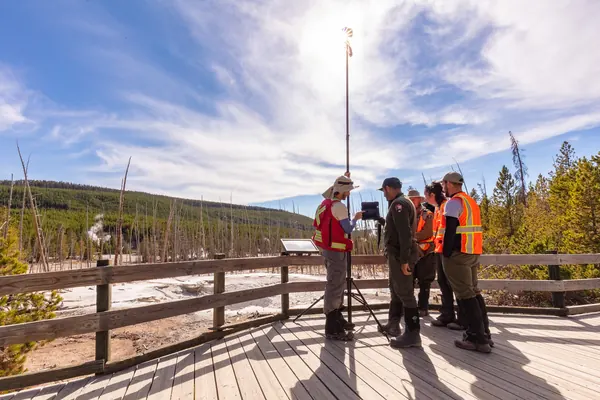
The mission is prepared well in advance: a stable weather window (light wind, no fog), a consistent sunlight period to avoid cast shadows that disrupt 3D reconstruction, and ground control points positioned by precision GPS to guarantee comparability between successive surveys, sometimes several years apart. The drone takes off from a point reachable on foot or by off-road vehicle, then flies over the glacier or slope under study following an automated flight plan in parallel lanes.
The hundreds of photos captured are stitched into a high-resolution digital terrain model, compared against previous surveys to precisely quantify the glacier front's retreat, subsidence linked to permafrost thaw, or the movement of an unstable rock slope. This kind of monitoring interests glaciology research labs as much as mountain resort managers, who face rockfall risks increased by permafrost thaw.
The specific regulatory framework for high-mountain flight
The flight generally falls under the open category, sub-category A3 in isolated high-mountain areas: 120 m maximum height above the terrain overflown, a remote pilot registered as an operator on AlphaTango. However, a large share of French glacial massifs lie within a national park or nature reserve, where drone flight is in principle banned unless specific scientific authorisation is granted by the manager — a point covered in our guide to flying over mountain nature parks.
High altitude adds its own technical constraint: thinner air reduces the drone's lift and endurance, which limits the area covered per flight and often requires several outings for a large glacier. Wind conditions, very changeable in the mountains, also restrict which windows are actually usable — a factor that weighs more heavily on planning than in lowland areas.
The price of a drone glacier monitoring campaign in 2026
The price mainly depends on how accessible the site is, how many days are needed to cover the whole area, and how often monitoring recurs. Orders of magnitude observed in France in 2026:
| Service | Observed price (excl. VAT) |
|---|---|
| One-off photogrammetric mission (1 day, high-mountain access) | €1,500 to €3,500 |
| Multi-year monitoring, annual rate (2 to 3 campaigns a year) | €3,000 to €6,000 |
| Processing and comparison of digital terrain models | +€400 to €900 per campaign |
These amounts include the time spent approaching the site and waiting for a favourable weather window, often longer than the flight itself in high mountains — a cost to plan for in the budget of a research or risk-monitoring project.
Frequently asked questions about drone glacier monitoring
Can the drone fly at very high altitude? Yes, but with reduced endurance: thinner air limits lift, which shortens the useful flight time compared with a lowland mission.
What accuracy is achieved on a glacial terrain model? On the order of a centimetre with well-positioned ground control points, sufficient to detect changes in volume or elevation between surveys.
Is special authorisation needed in a national park? Yes, almost always: a scientific authorisation request must be filed with the park manager well ahead of the mission.
How often should campaigns be repeated? It depends on the goal: annual monitoring is enough for long-term glacier retreat, while closer monitoring is needed for an unstable slope presenting an immediate risk.
Put it into practice
- Drone surveying & photogrammetry: rates and cities covered from €800
- Drone security & surveillance: rates and cities covered from €600
- Surveying & photogrammetry in Brest Bretagne
- Surveying & photogrammetry in Metz Grand Est
- Surveying & photogrammetry in Mulhouse Grand Est