CONTROLLED AIRSPACE GUIDE · UPDATED OCTOBER 2026
Drone missions in French controlled airspace: CTR, RTBA, NOTAM, ZICAD
New
For €39 VAT included (€32.50 excl. VAT): a guide to prepare a professional drone mission in France where the airspace is not free.
After payment
- The page after payment shows the link to your guide: you start reading right away.
- An email from C-DRONE (no-reply@tech-bharat.com) sends you this link again with your order details (amount, VAT, order number).
- Find my purchases gives you your links back at any time.
- No phone calls: nobody will ring you.
Guarantee: content as described, or your money back
For €110 more, the complete library: all 48 guides, this one included →
VAT included (€32.50 excl. VAT) · secure Stripe payment (card, Apple Pay, Google Pay) · terms of sale (in French)
What you get
- The online guide: 8 chapters, about 28 A4 pages, printable to PDF
- 6 ready-to-copy templates: protocol request to an air traffic service · agreement request to the manager of a restricted · email to the manager of an uncontrolled aerodrome · pre-flight zone check sheet · check log · ZICAD capture authorisation application · and 2 more
- For: Safety and QHSE managers
- Delivery: instant online access right after payment; Stripe invoice by email
- Preview: the whole first chapter, free, further down this page
8chapters
28printable A4 pages
6templates to copy
18checklist items
Checked at the source
Reviewed by industry professionals. Every rule links to its text.
322links to official texts across our guides
77automated checks before every release
October 2026latest revision of this guide
- Primary sources: Légifrance, EUR-Lex, Géoportail, DGAC, EASA.
- Every figure linked to its source, dated in the last chapter.
- Dated updates: you always read the latest version.
Who it is for
- Professional drone operators and remote pilots, French or foreign, preparing missions near French aerodromes, industrial, military or prison sites, or along long rural routes
- Clients commissioning drone work in France (construction, energy, industry, local authorities, engineering firms) who need to know whether a mission is feasible, how long it will take and what to require from the provider
- Surveyors, photogrammetry teams and film crews whose captures may fall inside a French no-capture zone (ZICAD)
- Safety and QHSE managers who keep the mission preparation file for their company
In pictures
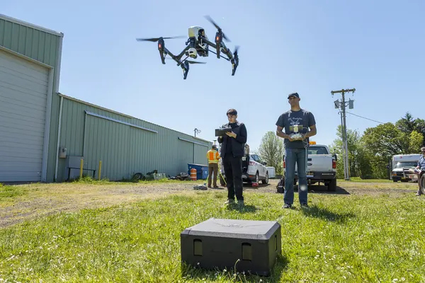
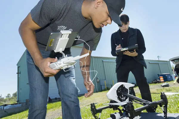
Illustrative photos, published by their authors under free licences.
Contents of the complete guide
- Reading the airspace: classes, CTR, TMA, LTA and P, R, D areas (free extract below)
- The UAS restrictions map and the other Géoportail layers
- Aerodromes and CTRs: agreement, protocol, notification
- Military activity and temporary areas: RTBA, AZBA, NOTAM, ZRT
- Sensitive sites: nuclear, military, prisons, natural areas
- ZICAD: the right to capture images
- The decision tree: which procedure, which lead time
- Six templates to copy
- Sources and dates consulted
Included: 18 checklist items and 11 decision or reference tables.
Introduction
A drone mission in France rarely fails because the flight is technically hard. It fails because an airspace constraint is found too late: the site sits inside an airport CTR and nobody asked the tower, a segment of the military low-flying network goes live on survey day, a temporary restricted area is published the evening before, or the photogrammetry flight plan covers a zone where capturing aerial data is prohibited. The flight is then cancelled on site, or flown illegally.
This guide is written to avoid both outcomes. It is for the operator preparing the mission and for the client commissioning it, including foreign teams who know EASA rules but not the French layer on top of them. It explains how to read the airspace above a site, which map layers to check and in what order, what each type of zone requires (agreement, protocol, notification, exemption), who the authority is and how much time to allow. It ends with a "which procedure, which lead time" decision tree and six ready-to-copy templates: protocol request, agreement request for a restricted area, email to an aerodrome manager, pre-flight zone check sheet, check log and ZICAD capture application.
The guide is up to date as of 29 October 2026. Every rule is tied to its text, and the texts cited were re-read on that date on Légifrance, in particular the order of 3 December 2020 as amended by the order of 23 December 2025. French texts are only authoritative in French; names of procedures are given in French where you will need them. Airspace data changes on 28-day publication cycles: maps, NOTAMs and the ZICAD list must be rechecked for every mission.
Reading the airspace: classes, CTR, TMA, LTA and P, R, D areas
Two systems on top of each other
Manned aviation divides the sky into volumes and classes. The classification comes from Annex 11 to the Chicago Convention and is taken up in Europe by Implementing Regulation (EU) No 923/2012, known as SERA. It describes the services air traffic control provides to aeroplanes and helicopters: who needs a clearance, who must be on the radio, who is separated from whom.
A drone answers first to another system: the UAS geographical zones created by Article 15 of Implementing Regulation (EU) 2019/947. Each State defines them for safety, security, privacy or environmental reasons. In France, they are translated into maximum heights on the restrictions map published on Géoportail.
The two systems meet in a French national text: the order of 3 December 2020 on the use of airspace by unmanned aircraft ("arrêté relatif à l'utilisation de l'espace aérien par les aéronefs sans équipage à bord"). It says what a drone must do in a prohibited, restricted or danger area, near an aerodrome and in controlled airspace. Reading an aeronautical chart therefore tells you why the drone map shows a given height, and which procedure to trigger.
Classes A to G on one page
| Class | Controlled? | What it imposes on manned aviation | Where it is used in France | What it changes for a drone below 120 m |
|---|---|---|---|---|
| A | Yes | Instrument flight only, clearance and radio | Busiest airspace, notably around Paris | Nothing by the letter itself; the drone map often shows 0 m near runways |
| B | Yes | All flights separated | Little or not used | Not applicable |
| C | Yes | Clearance and radio, controlled visual flight | Upper airspace, some large airports | Volumes generally far above a drone |
| D | Yes | Clearance and radio, traffic information | Most CTRs and TMAs, lower airspace | Only the part touching the ground (the CTR) matters |
| E | Yes | Visual flight without clearance | Some TMAs, lower airspace over mountains and at sea | Floors far above 120 m |
| F | No | Advisory service | Little or not used | Not applicable |
| G | No | Flight information and alerting | Everything else, the largest class | No aeronautical obligation, but P, R and D areas can overlap it |
A class is not a prohibition. It describes a level of service. A drone flying 40 m above a warehouse has no clearance to request because of the class, and no radio to keep. What concerns it are the volumes that come down to the ground, the special-status areas, and the drone-specific rules of the order of 3 December 2020: in the open category, its Article 5 for instance requires the agreement of air traffic control to fly in controlled airspace at 50 m or more above the surface (chapter 3).
Volumes: which one touches the ground
- FIR (flight information region): a large division of the territory for information and alerting services. No flight constraint in itself.
- CTR (control zone): controlled volume protecting arrivals and departures at an aerodrome. It is the only controlled airspace that starts at the surface. It is the one that matters for a drone.
- TMA (terminal control area): stepped volumes around and above one or more CTRs. Their floor is not at ground level.
- LTA and UTA: lower and upper airspace, thousands of metres up. Out of a drone's reach.
- SIV (French flight information sector): a service to aircraft, not a restriction.
The reflex: on an aeronautical chart, look first for the CTR, then for P, R and D areas. A TMA floor at 1,500 ft changes nothing for a flight at 60 m.
Special-status areas: P, R, D
P (prohibited), R (restricted) and D (danger) areas are not classes. They are overlaid volumes, published in the AIP France (section ENR 5.1) with their limits, hours and manager. Article 4 of the order of 3 December 2020 sets the rule for a drone:
- P area: no flight, unless the drone meets the entry conditions published for that area.
- R or D area: no flight, unless the aeronautical information explicitly allows it, or with the agreement of the area manager where the aeronautical information designates one.
- Establishments with distinctive markings: the remote pilot complies with the published overflight prohibitions and restrictions, in particular for establishments bearing low-level no-overflight markings, unless their manager has authorised it.
A P area can sit in class G, the "freest" airspace for an aeroplane, and still be prohibited. Conversely, a site in class D at the edge of a CTR can be flyable at a reduced height. Class and status are read separately.
What to keep in mind before opening the map
- The class letter does not tell you whether you can fly.
- The volumes that matter are those that touch the ground: the CTR, low-floor P, R and D areas, temporary areas.
- The UAS restrictions map already translates them into a height: it is the first document to open, not the last.
- Areas often have hours. An R area active Monday to Friday may be free on Saturday, and the reverse exists.
Why the rules are strict: what research measures
Manned aviation relies on "see and avoid". Against a small drone, it works poorly. A study by Ryan J. Wallace, Samuel M. Vance, Jon M. Loffi and co-authors, published in 2019 in the International Journal of Aviation, Aeronautics, and Aerospace (DOI 10.15394/ijaaa.2019.1421), measured pilots' ability to spot a small drone during final approach: it was seen in only 30% of approaches, and in only 13.6% when it was hovering. Successful sightings were almost all within a narrow cone around the line of sight. Around a runway, what protects is the capped height and the tower's agreement, not the aeroplane pilot's vigilance.
How it works
- You pay on StripeBy card, Apple Pay or Google Pay, in one go, on the checkout page hosted by Stripe: your card details never go through our servers.
- You read it right awayRight after payment, you land on the complete guide's page. Bookmark it or print it to PDF; the link and the invoice are emailed to you, and everything stays findable with “Find my purchases”, at the bottom of every page.
- Guaranteed contentAs described, or your money back: email devis@c-drone.fr and we restore access or refund you (terms of sale, in French).
Frequently asked questions
What does “Drone missions in French controlled airspace: CTR, RTBA, temporary areas, NOTAM, ZICAD and sensitive sites” contain and how much is it?
For €39 VAT included (€32.50 excl. VAT), you get drone missions in French controlled airspace: CTR, RTBA, temporary areas, NOTAM, ZICAD and sensitive sites: 8 chapters online, about 28 printable A4 pages and 6 ready-to-copy templates, to prepare a professional drone mission in France where the airspace is not free: read an aeronautical chart and the Géoportail layers, check the CTR and aerodrome surroundings, low-flying military activity, NOTAMs and temporary areas, nuclear, military and prison sites and protected natural areas, then the right to capture images in a ZICAD, and choose the procedure, the authority and the lead time that apply.
How do I receive the guide?
Right after payment you are redirected to the complete guide's page. Bookmark it, or print it to PDF (Ctrl+P or Cmd+P, “Save as PDF”). Stripe also emails you the receipt.
Do I get an invoice?
Yes: Stripe generates the invoice and emails it. You can enter your company name and VAT number at checkout. Seller: Lacangel Group (VAT FR21995268018); prices VAT included.
Is the guide kept up to date?
Yes. The guide's page is updated when the rules change; your access stays valid and you always read the latest version.
Which texts is the guide based on?
On the official texts in force (EU regulations, French decrees and codes), cited and dated with their links: you can check every rule at its source, which is authoritative. C-DRONE is an independent publisher.
Which device can I read it on?
Computer, tablet or phone: it is a web page, with no app or account to create. Print it to PDF to archive it or share it within your team.
What guarantee do I get?
The content matches its description, or you get your money back: email devis@c-drone.fr and we restore access or refund you (terms of sale, in French). This also applies to business purchases.
Other guides
New Drone light show guide
Organising a drone light show in France: budget, permits, contract
Town, company or wedding: check whether your project works, file the prefecture application on time, compare quotes, sign a contract that deals with the weather and run the night itself
€29 incl. VAT · €24.17 excl. VAT · 11 chapters · instant access
New CATS exam prep
Passing the French CATS drone exam: course and 104 practice questions
The eight subjects of the official DGAC syllabus summarised, 64 answered and explained questions, a 40-question mock exam and a four-week revision plan, with the French terms you will meet
€24 incl. VAT · €20.00 excl. VAT · 11 chapters · instant access
New Thermography guide
Drone thermography in France: commission, check and use the report
Roofs, facades, flat roofs, solar PV: choose the right measurement window, write the specification, check the flight conditions, read the report in fifteen minutes and turn it into repair decisions
€29 incl. VAT · €24.17 excl. VAT · 11 chapters · instant access
Free articles on the topic
- RTBA (military very-low-level network): what a professional drone operator must check before a mission
- Airspace classes A to G, CTR, TMA, LTA: reading an aeronautical chart before a drone mission
- ZICAD in France: List, Map and Exemptions for Drone Data Capture Zones
- Drone Mission Inside an Airport CTR: Who to Contact, What Delay, What Protocol
- NOTAM and temporary restricted airspace: the checks before a professional drone mission
- Drones and Prisons: No-Fly Ban, Penalties and Regulation of a Correctional Facility
Instant access to your guide after payment · terms of sale (in French). Questions before buying: devis@c-drone.fr.