
C-DRONE GUIDE · 18 JULY 2026
Dam and levee inspection by drone: method, regulations and price
Across France, a long network of levees protects inhabited areas from flooding, and numerous dams hold back water whose slightest failure could have dramatic consequences. Since 2018, surveillance of these structures has mostly fallen to inter-municipal bodies under the GEMAPI competency, with staffing rarely matched to the length of structure that needs walking. The drone does not replace the engineer who interprets the data, but it changes the game for field data collection: a comparative 3D model from one campaign to the next, thermography to spot seepage invisible to the naked eye, safe access to the hardest-to-reach areas. Here is how an inspection mission works, what the regulations say, and what it costs in 2026.
Get up to 3 quotes from professional drone pilots in your area
Describe the mission in two steps. With your consent, it is passed on to partner professional pilots (3 at most), who contact you directly with their proposal.
Published on 18 July 2026, updated on 22 September 2026 — regulations in force as of September 2026.
Why walking the levee on foot is no longer enough over several kilometres
A flood-protection levee can run for several kilometres along a river or an estuary, with a waterside slope, a crest and a landside slope that an inspector has to walk on foot to spot a crack, a settlement, an erosion patch or the entrance to a coypu burrow — one of the best-documented causes of levee failure, since the tunnel dug by the burrowing animal weakens the body of the structure without leaving any visible trace on the surface until it collapses under water pressure. On a dam, access to the upstream face, the toe of the structure or the surrounding rocky terrain is sometimes simply dangerous or impossible without a helicopter or a rope-access team.
Statutory visual surveillance remains essential, but it has blind spots: it captures a single moment, not a trend, and it depends on the vigilance and availability of whoever walks the structure. Precisely comparing the state of a slope six months apart, or objectively measuring a settlement of a few centimetres over dozens of metres, is beyond what an eye and a tape measure can document in a usable way over time.
What the drone adds: change detection, seepage, invasive vegetation
A photogrammetric flight produces a centimetre-accurate 3D model and orthophoto of the whole structure or stretch of levee. Repeated every six months or every year, it lets two surveys be overlaid so the differences stand out automatically: a settled crest, a slipping slope, progressive erosion on the water side — millimetre to centimetre-scale changes invisible from one walk-through to the next, but readable once the two point clouds are compared. It is the same comparative-tracking principle we cover for stockpile volume measurement in quarries, applied here to ground movement rather than stockpile tracking.
The thermal camera targets a risk specific to hydraulic structures: seepage. A spot where water infiltrates through the body of an earth levee or under a dam changes the local surface temperature compared with the rest of the slope, a gap that aerial thermography can reveal early in the morning, before the sun evens out temperatures. A standard visual flight rounds out the picture by mapping shrub growth or large roots colonising a slope — cover that hides the surface from a ground inspector and that a vegetation-management plan must regularly clear to keep visual surveillance effective.
GEMAPI and the regulatory classification of structures
Since 1 January 2018, the competency for managing aquatic environments and preventing flooding (GEMAPI) has been handed to inter-municipal bodies, which inherited the maintenance and surveillance of levees in their territory — often ageing structures whose owning town no longer always had the staff to keep up regular monitoring. Decree n° 2015-526 of 12 May 2015 sorts every dam and every levee system into four classes, A to D, based on the population protected or exposed in case of failure, with surveillance and documentation duties (a hazard study, a surveillance report, an in-depth technical inspection) that get stricter as the class rises.
A drone survey does not replace these documentation duties, but it makes them easier to carry out: georeferenced images and the 3D model feed directly into the surveillance report and the in-depth technical inspection required by the regulations, with a dated audit trail the inter-municipal body can produce if checked by the state services in charge of hydraulic structure safety.
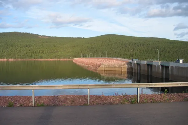
What aviation rules say about flying over a dam
The flight itself mostly falls under open-category sub-category A3: far from third parties, with the operator registered on AlphaTango. But one point specific to large dams is worth knowing before planning a mission: several hydroelectric structures, notably in the Verdon gorges (Castillon, Chaudanne, Sainte-Croix), are treated as sensitive sites where flying over the structure is strictly forbidden, marked on site by a dedicated sign. Article R133-10 of the transport code still allows a prefectural waiver for a security mission, agricultural surveillance or a public-works mission — a category a structural inspection commissioned by the structure's operator falls under — by submitting a file with a safety study, proof of insurance and evidence of the pilot's qualification.
Before any flight, the Géoportail drone map remains the first thing to check, to see whether the structure or its surroundings are classed as a no-fly zone or subject to prior approval, on top of the protected natural areas often found around reservoirs. We cover how to read that map in our guide to the Géoportail drone zone map, and the distinction between categories in open versus specific category.
The price of a dam or levee inspection mission in 2026
The price mainly depends on the length of the structure or its height, how many sensors are used (visual, thermal, LiDAR) and the level of analysis the owner needs. Ranges observed in France in 2026:
| Mission | Observed price (excl. VAT) |
|---|---|
| One-off photo survey of a small municipal levee (a few hundred metres) | €350 to €700 |
| Full diagnostic of a multi-kilometre stretch (orthophoto + comparative model) | €1,000 to €2,500 |
| Medium to large dam (photogrammetry + thermography + report) | €1,500 to €3,500 |
| Multi-year surveillance programme (several campaigns, tiered pricing) | quote on request |
Worth comparing with bridge and structure inspection, which follows the same pricing logic: the drone does not replace the engineer who interprets the data, but it sharply cuts the time and risk tied to field data collection — a budget many inter-municipal bodies now arbitrate as part of their multi-year GEMAPI management programme rather than project by project.
Frequently asked questions about drone dam and levee inspection
Can a drone replace the statutory in-depth technical inspection? No: it makes data collection easier, but the analysis and the regulatory conclusion are still produced by the qualified people appointed by the structure's operator, as required under decree n° 2015-526.
Does flying over a dam always require special authorisation? Not always, but it must be checked case by case: some large hydroelectric structures are classed as sensitive sites with flight over the structure forbidden except by prefectural waiver, while other levees or small dams only need a standard open-category flight.
Does thermography catch every seepage point? It reveals surface temperature gaps that point to abnormal water movement, but a deep or recent infiltration may not yet have created a detectable thermal signature: it complements other monitoring methods (piezometers, visual inspections) rather than replacing them.
How often should flights be scheduled? The pace depends on the structure's class and the surveillance plan in force; one flight a year, plus an extra pass after a significant flood or drought episode, covers most needs.