C-DRONE GUIDE · 19 JULY 2026
Drone roof survey before installing solar panels: layout study and what to check
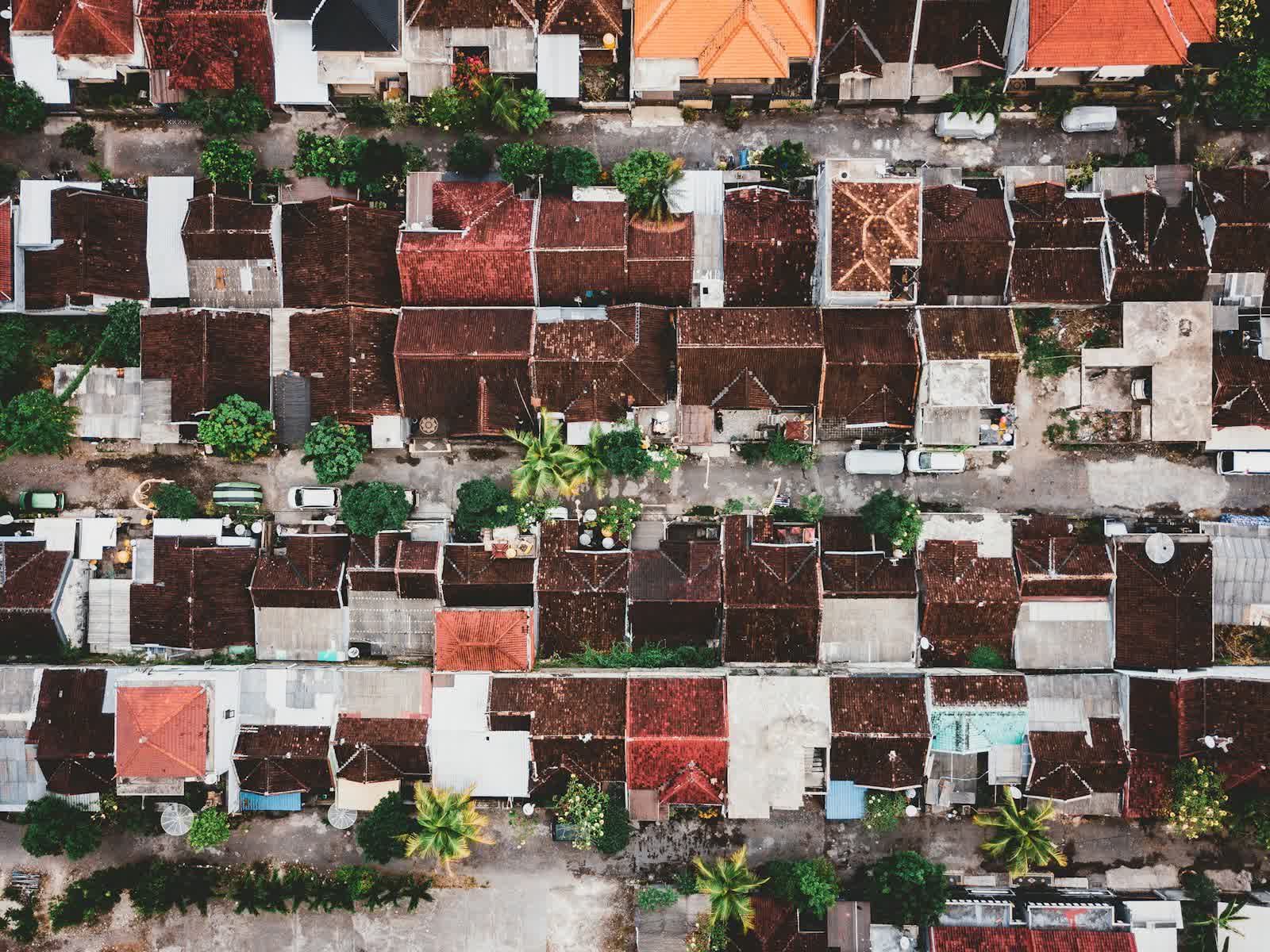
Installing solar panels on a poorly surveyed roof is the surest way to cap your output from year one: an under-used section, a chimney shading a quarter of the modules in winter, a frame that cannot bear the stated weight. Before any serious quote, the installer needs an accurate layout study — the plan that positions each module on the roof, accounting for its real shape, orientation, pitch and the shadows cast around it. A ground survey, done with a tape measure and a smartphone, stays approximate and misses complex roofs (multiple sections, dormer windows, chimneys) or hard-to-reach attics. A photogrammetric drone flight changes that: in about thirty minutes it produces a millimetre-accurate 3D model of the roof and its surroundings, the working basis for the layout plan, the shading simulation and a condition check before work starts. Here is how this survey works, what it checks, and what it costs in 2026.
Get up to 3 quotes from professional drone pilots in your area
Describe the mission in two steps. With your consent, it is passed on to partner professional pilots (3 at most), who contact you directly with their proposal.
Published on 19 July 2026, updated on 22 September 2026 — regulations in force as of September 2026.
Why the layout study comes before the first quote
A solar installation quote almost always starts with a remote estimate: roof area read off a satellite view, an approximate orientation, an online simulator projecting theoretical output. This first pass is enough for a rough order of magnitude, but it misses what actually separates a profitable installation from a disappointing one: the section's real pitch (rarely the standard 30° used by simulators), roof set-backs, the chimneys, aerials and roof windows that shrink the usable area, and the shadows cast by the building itself or by its immediate surroundings.
The layout study — the plan that positions each module on the roof while accounting for these constraints — is the step that turns an estimate into a costed project. Done approximately, it either leads to under-sizing the installation out of excessive caution, or, worse, to overstating the output promised to the customer, with the risk of a dispute once the installation is up and the real yield measured falls short of expectations.
What the photogrammetric flight measures: orientation, pitch, usable area
The flight follows a regular grid over the roof and its immediate surroundings, at 20 to 40 m depending on the size of the building, with a high overlap between shots (at least 80%) to allow a reliable reconstruction. The hundreds of photos are assembled into a point cloud and then a textured 3D model, accurate to the centimetre: each section's orientation to the degree, its real pitch, and the usable area worked out by subtracting whatever reduces it (a chimney, a roof window, an aerial, an uneven ridge line).
That model imports directly into the sizing software used by design offices, which produce the final layout plan from it — number of modules, wiring, production strings — and a far more reliable estimate of annual output than a satellite reading. We cover the same modelling principle, applied to the whole building, in our guide to drone photogrammetry and 3D modelling, and how to choose software in drone photogrammetry software.
Shading, the factor that can wreck a roof section's output
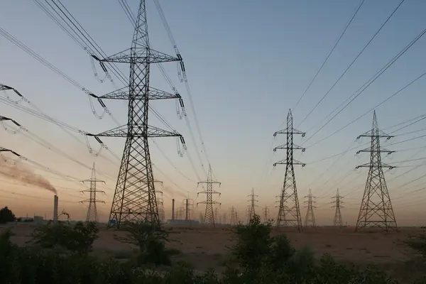
A partially shaded module, even over a small portion, does not just lose the output of the shaded area: without an effective bypass diode, it can throttle the output of an entire string of modules wired in series. A chimney, a neighbouring tree, an overhead power line, or simply the building next door casts a shadow whose position shifts through the seasons and the hours — an obstacle that looks harmless at noon in midsummer can cover a whole section in the early morning at the winter solstice.
The 3D model from the drone flight makes it possible to simulate the sun's path across a full year and precisely map the areas of cast shadow, including those from distant obstacles (a neighbouring building, a high-voltage line) that a ground survey struggles to capture as a whole. That simulation directly shapes where modules are placed — keeping a full string off the most exposed area rather than spreading the loss across the whole installation — and can tip the choice between a central inverter and micro-inverters, the latter confining the effect of partial shading to a single module rather than a whole string.
Roof and frame condition — and the asbestos question
The same flight, backed up with close-up shots of the areas that need them, also acts as a visual condition check of the roof before work starts: cracked or shifted tiles, loose slates, a degraded ridge, moss patches holding moisture — all things that, left untreated before installation, will compromise the waterproofing under the modules for the twenty to twenty-five years of the installation's warranty. On an older frame, the high-resolution photos often reveal deformation or sagging visible from outside, to be confirmed if needed by an inspection inside the attic.
One point deserves particular care: for buildings whose planning permission predates 1 July 1997, French regulations require an asbestos diagnostic before work (DAAT), carried out by a certified surveyor independent of the installation company, before any intervention on the roof — especially where the roofing is fibre-cement sheeting. The drone flight does not replace this statutory diagnostic, which requires physical sampling, but it does let you visually spot a fibre-cement roof and order the DAAT ahead of time rather than discovering the constraint once the installation crew is already on site.
Aviation rules and how a mission unfolds
The flight usually falls under open-category sub-category A3 for a standalone roof, or A2 when it comes closer to the building's occupants or the immediate neighbourhood, with the pilot registered as an operator on AlphaTango. In built-up areas, professional open-category flight over public space has been allowed in daytime since 1 January 2026 (order of 23 December 2025); depending on the site, a prior declaration to the préfecture may still be needed, with ten working days' notice to build into the project schedule. Before any flight, the Géoportail drone map remains the first thing to check for local restrictions — we cover how to read that map in our guide to the Géoportail drone zone map, and the distinction between categories in open versus specific category.
On the ground, the mission usually takes thirty to sixty minutes of flight for a single house, more for an industrial or agricultural building with an extensive roof. The report, delivered within 48 to 72 hours, includes the 3D model ready for sizing software, an orthophoto of the roof, orientation and pitch measurements per section, and a photo survey of the roof's condition.
The price of a drone survey before solar installation in 2026
The price mainly depends on the roof's size and complexity (number of sections, set-backs, accessibility) and the level of deliverable the design office needs. Ranges observed in France in 2026:
| Mission | Observed price (excl. VAT) |
|---|---|
| Single house, simple roof (1 to 2 sections) | €250 to €450 |
| House or small building, complex roof (several sections, dormers) | €450 to €750 |
| Commercial or agricultural building, extensive roof (barn, warehouse) | €750 to €1,500 |
| Ground-mounted array or solar carport: combined site study | quote on request |
This preliminary survey is distinct from services carried out once the installation is up: drone solar panel cleaning and the annual thermal inspection of panels, priced respectively on installed area and array output. Many installers now fold this drone survey directly into their design quote rather than billing it separately.
Frequently asked questions about roof surveys before solar panels
Does the drone replace the installer's technical visit? No: it supplies the layout data and a visual condition check of the roof, but the installer stays responsible for electrical sizing, choice of equipment, and an attic inspection if a structural doubt comes up.
Does the flight detect asbestos? No: it lets you visually spot a fibre-cement roof that might contain it, but only an asbestos diagnostic before work, carried out by a certified surveyor with physical sampling, has regulatory value.
When should the flight be scheduled relative to the works? Ideally as early as the design phase, before the final quote is issued: the layout drawn from the 3D model determines the number of modules offered and the output promised to the customer.
Does this survey work for an already-equipped roof you want to extend? Yes, the same flight checks the remaining usable area and the shading on the planned extension zone, under the same conditions as for a new installation.
Put it into practice
- Drone roof inspection: rates and cities covered from €200
- Drone aerial thermal imaging: rates and cities covered from €500
- Roof inspection in Dijon Bourgogne-Franche-Comté
- Roof inspection in Le Mans Pays de la Loire
- Roof inspection in Perpignan Occitanie