A professional drone pilot for this mission Request a free quote
C-DRONE GUIDE · 25 AUGUST 2026
Drones for masonry and structural works contractors: quoting, diagnosing, monitoring a site, price
A cracked gable that has to be priced when nobody can get close to it, a render repair whose area is guessed from the pavement and never measured, a cherry picker hired for half a day just to look at a wall coping, a tender due in eight days on a four-storey building : for a masonry or structural works contractor, visual access remains the first bottleneck of pre-sales. A drone lays no blocks, but in an hour on site it delivers what scaffolding used to take a day to provide : a facade rectified to scale, a survey of visible defects, a defensible take-off and a dated photographic file. Here are the uses that hold up on a real site, the ones that do not, and 2026 prices.
Published on 25 August 2026, updated on 22 September 2026 — regulations in force as of September 2026.
Pricing a masonry repair without erecting scaffolding
The first use is a pre-sales one, and it is the most profitable : measuring a facade without reaching it. A twenty to thirty minute flight in parallel passes produces a rectified orthophoto — an image of the facade seen head-on, stripped of perspective, on which a distance measured on screen equals a real distance. Scaling relies on two or three tape measurements taken from the pavement (a window width, a sill height) or on targets laid on the ground ; the useful resolution sits around 2 to 5 mm per pixel, more than enough to read a block joint or the edge of a reveal.
From there, the take-off becomes desk work : gross facade area, deduction of openings counted one by one, linear metres of banding, sills and cornices, and the render area genuinely needing repair — because a partial repair can be outlined polygon by polygon on the image, zone by zone, instead of being lump-summed by eye. This is exactly the data produced by a drone facade survey for an architect, except that the contractor uses it for a bill of quantities rather than for elevation drawings. Our facade inspection drone page sets out the service and its deliverables.
The limit is clear and worth stating to the client : the drone measures what it sees head-on. Thicknesses, window reveals, the back of a setback, the depth of a chase do not come out of an orthophoto. Those items are still measured on site, or lump-summed — but they now make up a fraction of the take-off instead of all of it.
Surveying structural defects visible from outside
The second use is preliminary diagnosis. On a rendered facade, the flight records and locates what the eye can read : crazing — that shallow polygonal network of micro-cracks, generally under 0.2 mm, caused by differential shrinkage in the render —, the clearer cracks that cluster at singular points (lintels, window sills, material changes), and the stepped structural cracks that follow the masonry joints and exceed a millimetre. This gradation is not cosmetic : it determines the treatment system chosen for the renovation, a subject covered in our guide to facade diagnosis before renovation.
On a cast in-situ concrete structure, the drone documents another family of defects : spalled corners, cover breakouts exposing reinforcement, rust runs betraying ongoing corrosion under insufficient cover, and the fins and honeycombing left over from the pour. On copings, finally — boundary wall cappings, parapet flashings, chimney stacks, gable verges — the drone reaches what nobody ever looks at : yet these are the most frequent water entry points, and the repair item most often missing from a quote drawn up at ground level.
Comparison over time is the method's real contribution. A study by Chaiyasarn, Buatik, Mohamad, Zhou and Poovarodom, published in 2023 in the Journal of Architectural Engineering, shows that a photogrammetric 3D model built from imagery can automatically detect the evolution of defects in a masonry structure between two campaigns, removing the viewpoint differences that make two ordinary photo sets impossible to compare (see the study). For a contractor this translates simply : two flights six months apart beat a long argument about whether the crack has moved.
What the drone does not replace: sounding, investigation, the engineer
The boundary deserves plain speaking, because a poorly briefed client sometimes expects the drone to deliver a conclusion no image can carry. Render that sounds hollow cannot be seen : debonding is detected by percussion sounding, hammer or mallet, hand on the substrate. An image, even at 2 mm, shows a halo, a shade difference, a slight bulge — clues, not findings. Likewise, reinforcement cover depth is measured with a cover meter, concrete carbonation with a phenolphthalein test on a fresh break, and whether a crack is still moving is established with a fixed gauge read over months.
Three limits, then, to state in the report itself. The drone does not sound : it never touches the structure. It does not diagnose the cause : a stepped crack on a gable may come from differential foundation settlement, from clay shrink-swell, or from a plain render defect, and only cross-checked investigation — including a soil survey where relevant — can settle it. It does not replace the structural engineer : any conclusion on stability, on the need for propping or on the sizing of a repair belongs to an engineering firm, bound by its own liability.
What the drone does do, faster than any other method, is rank. In a single campaign the contractor knows which areas warrant a platform and a sounding survey, and which do not. It is a triage tool ahead of intervention, not a substitute for expertise — and that alone is the difference between a quote priced by guesswork and a quote priced on evidence.
Monitoring elevation, pouring and earthwork volumes
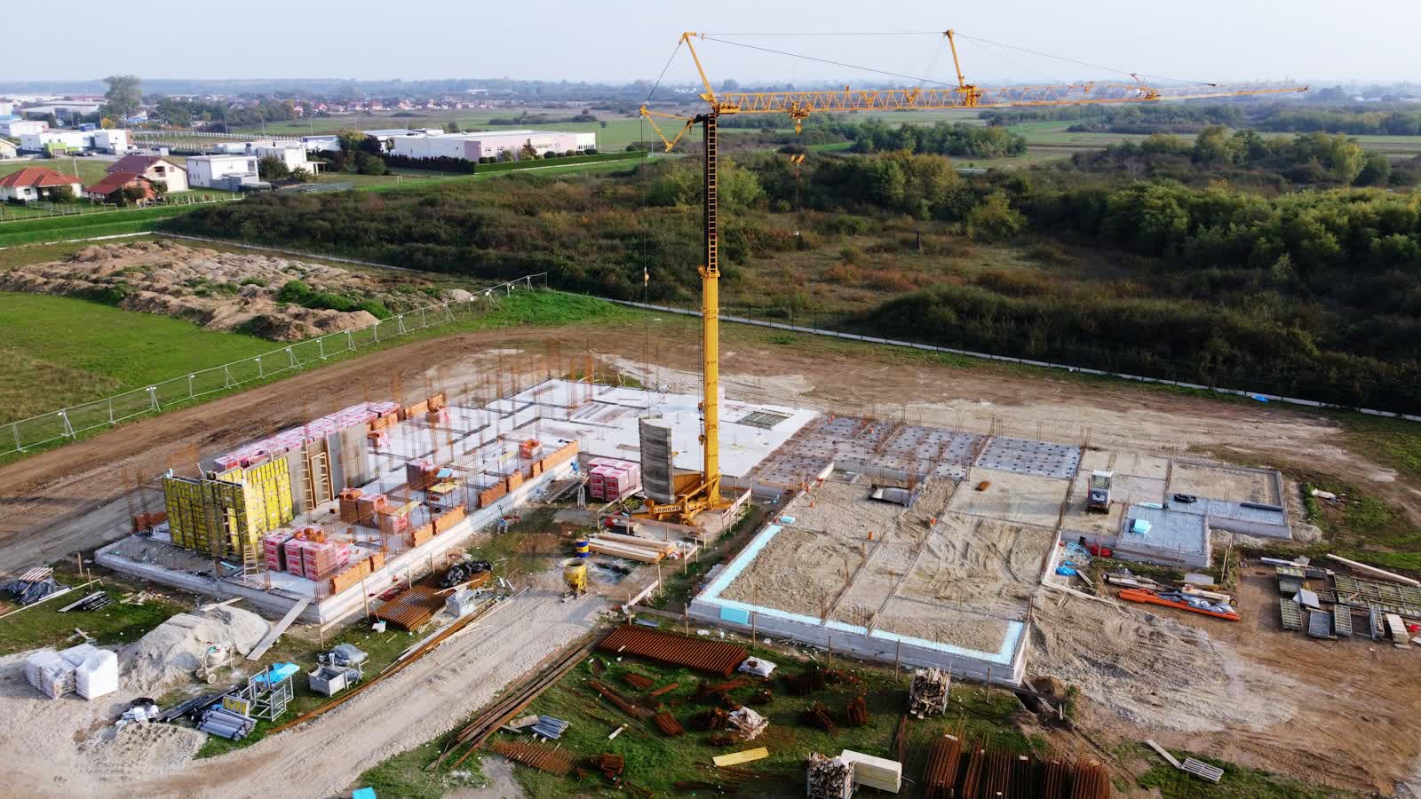
Once the contract is signed, the same tool serves a different purpose : reporting. A monthly pass produces a site orthophoto and a few oblique views that tell the progress story better than any meeting minutes : excavation bottom and shoring, reinforced footings before pouring, formwork sequence and level reached, floor slabs laid, perimeter backfill, site facilities and storage areas. For a structural works contractor reporting to a client or a works supervisor, this dated image set replaces much of the back-and-forth of phone photos — and it works as well to justify a payment application as to explain a setback. Our construction monitoring drone hub details the delivery formats.
On the earthworks phase, photogrammetry adds a quantitative layer : a digital terrain model rebuilt at each pass allows volumes to be computed by difference — material excavated, fill placed, topsoil stockpiled for reuse — and quantities billed to be reconciled against an independent measurement rather than a count of truck rotations. The method, its ground control points and its accuracy figures are detailed in our guide to earthworks monitoring on development sites.
A practical note : the useful frequency is not the maximum frequency. On a standard structural works site, a monthly pass is enough to document progress ; you tighten to weekly during a critical phase (sloping excavation, a sensitive pour, work at a property boundary) and then space it out again. Billing twelve passes when four would do serves nobody.
The evidence use: neighbours, handover, disputes
This is probably the most underrated use, and the cheapest relative to what it avoids. Before opening an excavation or starting underpinning, a flight freezes the condition of neighbouring properties : party walls, gables, chimney stacks, roofs, boundary walls. Six months later, when a neighbour reports a crack "that appeared with your works", the question is settled on dated imagery instead of on assertions. Within a pre-construction condition survey — the expert assessment ordered before works under article 145 of the French code of civil procedure — these views feed directly into the expert's record, as detailed in our guide to the condition survey of neighbouring buildings.
At the other end of the job, handover raises the same need in reverse : documenting the finished work from angles unreachable during the walk-through, closing out defects on evidence, and building the dated baseline that will matter if a problem appears during the warranty period — covered in our guide to works acceptance and the ten-year warranty. A few hundred euros of flying weigh little against the cost of a contested defect item.
Finally, when a dispute is already under way — an alleged defect, damage to a neighbouring structure, disagreement over the source of water ingress — the contractor has every interest in a technical file assembled properly from the outset. Our guide to expert assessment in construction disputes sets out what an aerial survey must respect to be usable in proceedings : traceable date, equipment and method, no retouching, and disclosure to all parties.
What it changes inside the company: platforms, safety, deadlines
Three concrete effects, visible in the accounts. First, the survey platform disappears. Hiring a machine, transporting it, obtaining a road occupation permit, tying up two workers for half a day : all of that is still needed to carry out the work, but no longer to go and look. The platform is then ordered once, for the right duration and the right spot, because the scope is already known.
Second, safety. A mason is exposed at height from the first floor up, and survey visits — brief, unplanned, made "just to look" — concentrate a disproportionate share of the risk. The Bayesian network analysis by J. E. Martín, T. Rivas, J. M. Matías, J. Taboada and A. Argüelles, published in 2009 in Safety Science from several thousand fall-from-height workplace accidents, highlights the weight of organisational factors such as the type of task, its duration and company size in the severity of these accidents (see the study). Removing observation climbs, while changing nothing about production climbs, strips out exactly the least justifiable exposure. It is the same reasoning set out in our guide to drones for roofing tradespeople, transposed to structural works.
Third, response time. On a tender due in eight or ten days, visual access is often what makes a contractor give up : no platform slot, no way to see the fourth elevation, hence a cautious price — or no bid at all. A flight is booked within 48 hours and delivered within 72 : the contractor bids, and bids on measured areas. Within a given area, pooling three to five surveys into one round pushes the unit cost down to a level where profitability stops being a question.
Method, flight framework and prices
A typical mission takes half a day on site. Briefing with the site manager or company owner on the objective — take-off, diagnosis, progress, evidence —, review of access and sensitive areas, two or three ground scaling measurements, then the flight : parallel passes at constant standoff for the facade orthophoto, oblique views targeting singular points (lintels, sills, copings, chimney stacks, gable verges), and a grid flight plan for the site footprint and volumes. Processing delivers within 48 to 72 hours a rectified orthophoto usable to scale, a defect location sheet, the take-off of areas and linear metres, and where relevant a digital terrain model with volumes.
Two layers of framework overlap. The site layer first : written consent from the client, entry of the intervention in the site safety plan, notice to the safety coordinator, and explicit coordination with the crane operator — flying with the crane stopped, or well clear of the jib's slewing radius. Neighbours are informed when the flight runs along property boundaries : shots are framed on the structure, and bystanders or interiors visible through a window are blurred, which settles the privacy question before it arises. The aviation layer second : the flight is prepared against the official restriction map, and in built-up areas it falls, since 1 January 2026, under the framework opened to declared professional operators subject to strict conditions — prior declaration and an appropriate scenario. Our guide to flying a drone in French cities details what is actually allowed.
Ranges observed in 2026 (excl. VAT) :
- Take-off and diagnosis of one facade (house or small block, two to three storeys, rectified orthophoto and defect survey) : €300 to €600.
- Standard building, several elevations (four to eight storeys, street and courtyard elevations, location sheet) : €600 to €1,500.
- Pooled round for a contractor (3 to 5 surveys in one area, same day) : €150 to €300 per building.
- Baseline site survey with volumes (footprint up to 20 ha, DTM and volumes per zone) : €800 to €1,500.
- Monthly progress pass (site orthophoto, oblique views, comparison with the previous pass) : €600 to €1,200 per pass.
- Condition survey of one neighbouring building (facades, roof, stacks, located report) : €400 to €800 per building.
- Handover flight or evidence file (finished work, located defect items) : €500 to €1,200.
The items driving the price are building height, the number of elevations, the scaling accuracy required and any built-up area constraint. Request a quote stating the site address, the number of storeys, the type of structure (rendered masonry, in-situ concrete, stone) and the objective — pricing, diagnosing, monitoring or evidencing.
Frequently asked questions
Is a drone-based facade take-off reliable enough to commit to a quote?
Yes for areas and linear metres on a flat facade, provided the orthophoto is scaled against at least two ground-measured distances (floor height, window width) and the provider states the accuracy achieved. On a standard facade the deviation stays around a centimetre, which is ample for a render or repair quote. What the drone cannot see are thicknesses, window reveals and the back of any setback : those items still have to be measured on site or covered by a lump sum.
Can a drone tell whether a crack is structural?
No. It documents a crack's visible geometry — path, length, estimated width, position relative to singular points — and lets you compare two campaigns a few months apart. But the cause of the defect and whether it is still moving are matters for physical investigation : hammer sounding, a fixed crack gauge, a cover meter, sometimes a soil survey. An honest drone report ranks the areas to investigate; it never concludes on a structure's stability.
Can a drone fly over an active structural works site?
Yes, but the flight is prepared like any activity carried out alongside others : written consent from the client, entry in the site safety plan, notice to the safety coordinator, and above all coordination with the crane operator — either a slot with the crane stopped, or a flight area well clear of the jib's slewing radius. In built-up areas the aviation framework applies on top : since 1 January 2026, flying over public space is open to declared professional operators under strict conditions.
Put it into practice
- Drone construction site monitoring: rates and cities covered from €250
- Drone security & surveillance: rates and cities covered from €600
- Construction site monitoring in Troyes Grand Est
- Construction site monitoring in La Roche-sur-Yon Pays de la Loire
- Construction site monitoring in Laval Pays de la Loire